
The following maps were released to the public in October of 2015 by the Province of Alberta, and rather than relying on older or historical maps of the project, I wanted to ensure that the most up-to-date information was available to readers. These are likely to remain the most current views of the road until a contractor is selected in September of this year.
Please click on the maps for larger versions.
Southwest Calgary Ring Road Route
From North to South, the following maps show the full route of the Southwest Calgary Ring Road project as it currently stands:
1) While not part of the Southwest Calgary Ring Road, Highway 8 from Lott Creek Boulevard to the Calgary City Limits at 101st Street SW will be twinned as part of the project, including a new bridge over the Elbow river.
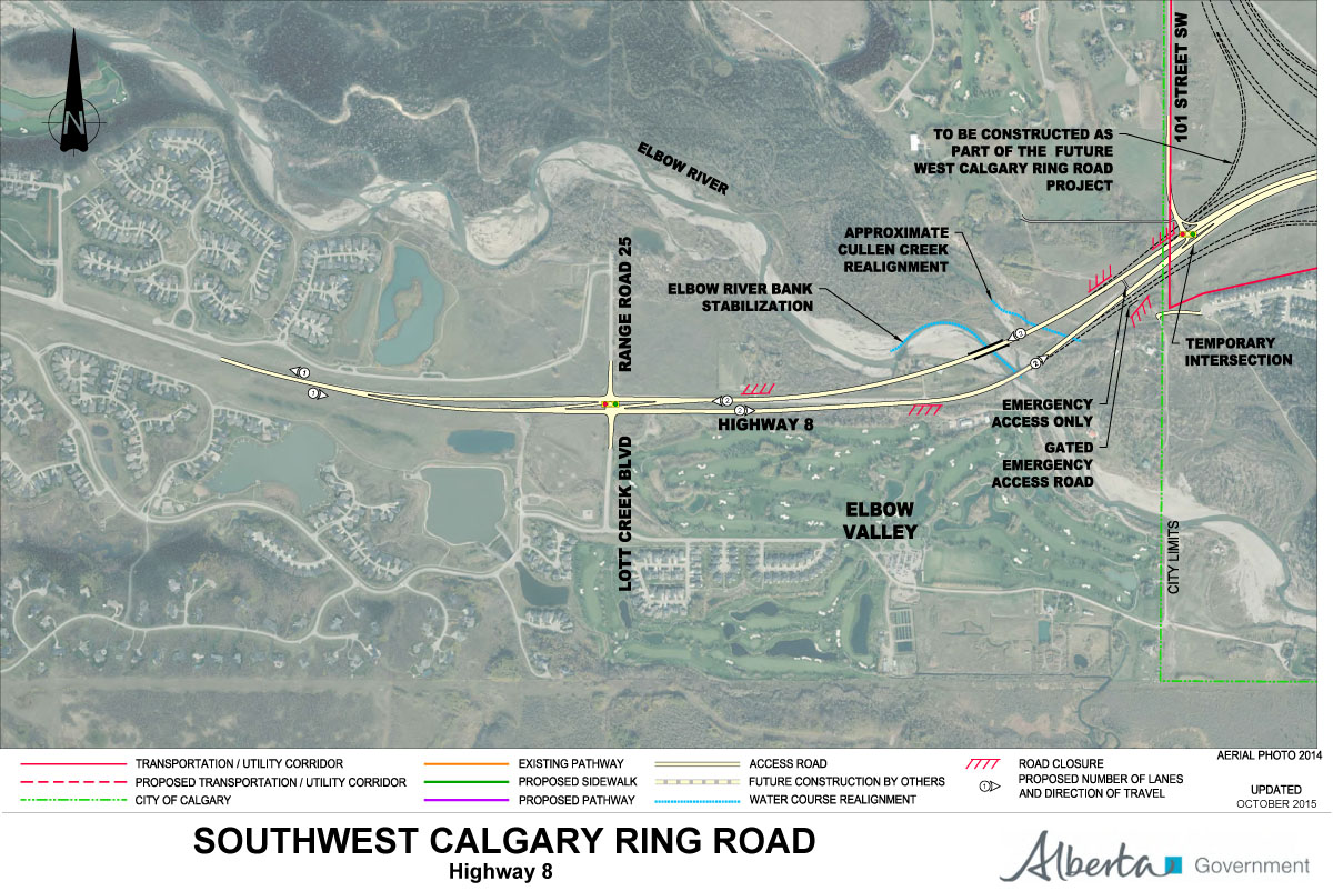
2) The Southwest Ring Road begins at the Highway 8 Corridor, from Calgary City Limits at 101st Street SW, to the interchange at 69th Street SW.

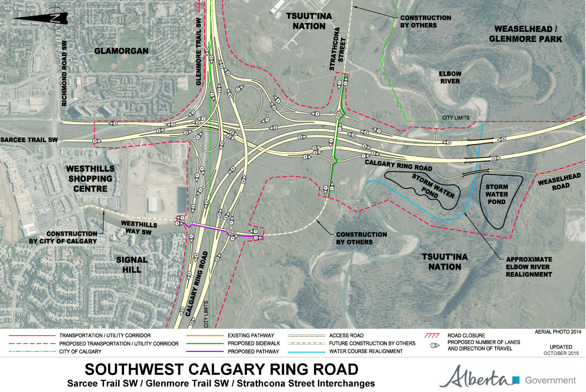
3) Interchange of Glenmore Trail SW and Sarcee Trail SW, including Glenmore Trail upgrades between Sarcee Trail SW and the 37th Street SW interchange. Also shown are the interchanges with Westhills Way SW and Strathcona Street.

4) South of Glenmore Trail/Highway 8 over the Elbow River, adjacent to the Weaselhead.
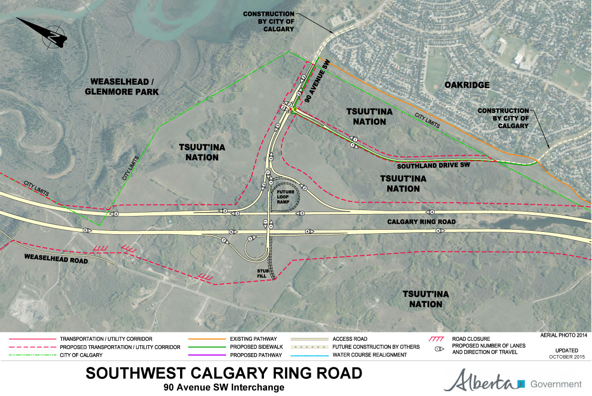
5) Interchange with 90th Avenue SW and connection to Southland Drive SW.
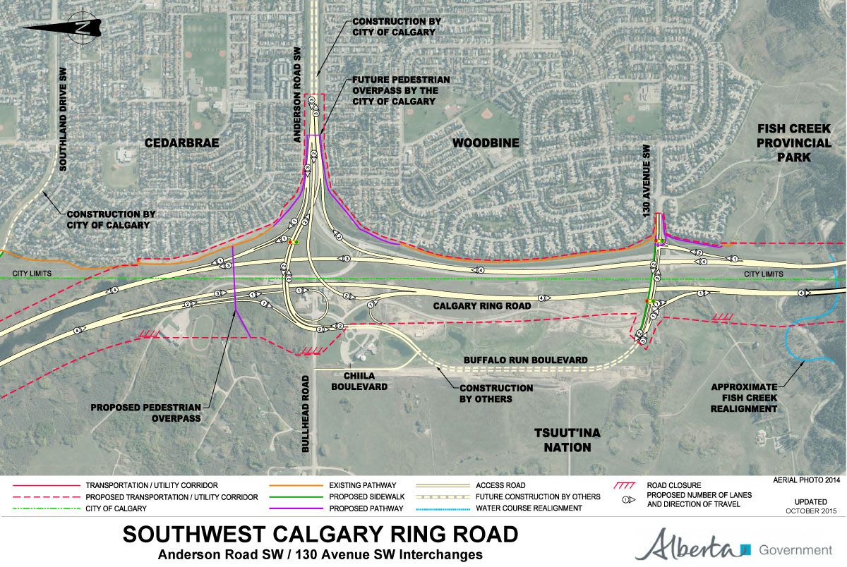
6) Interchanges at Anderson Road SW and 130th Avenue SW/Buffalo Run Boulevard.
7) Interchanges at Fish Creek Blvd and 162nd Avenue SW.

8) Interchanges at Highway 22X and James McKevitt Road SW/Spruce Meadows Way SW.

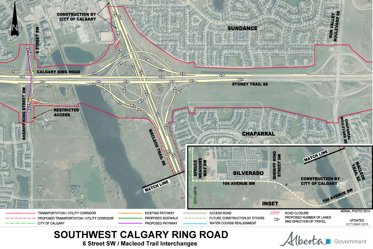
9) Interchanges at MacLeod Trail SE and Sheriff King Street SW/6th Street SW.
10) In addition to the main route of the Southwest Calgary Ring Road, the Province will be undertaking improvements to a portion of Highway 22X, west to 69th Street SW.

Source: https://www.transportation.alberta.ca/sw-crrgp.htm. All maps retrieved October 14 2015.

Your site is missing this map for Fish Creek Blvd / 162 Ave:
Click to access SW-CRR%20-%20Fish%20Creek-162nd%20Avenue%20SW.pdf
Thanks for catching that! The post has now been updated.