
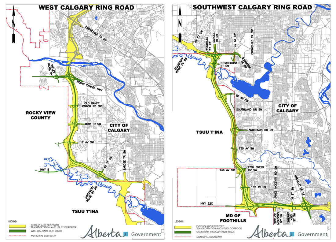
The Provincial Government today released the functional design plans for the West and Southwest Calgary Ring Road project. Starting at the Bow river crossing of Stoney trail NW and heading south to Macleod trail at Highway 22x via the Tsuut’ina reserve, this last section of the ring road measures 31km, contains 66 bridges, 20 interchanges and several crossings of the Bow river, the Elbow river and the Fish creek. A full breakdown of the details can be found here, or at the Alberta Transportation website here.
Though the new release contains little new information on the physical road itself, one of the major changes announced involves the staging of construction. While the Province and the Tsuut’ina Nation are still awaiting the Federal Government to approve the land transfer that was agreed upon last year, the Province has stated that rather than build the West leg first, as was previously announced, the Southwest leg of the road would be the first to start construction. The timelines are currently unchanged from earlier estimates, and it is hoped by the Province to have a contractor awarded and construction begun in 2016.
Other key points:
• 80,000-100,000 cars are projected to use certain sections of the road.
• Data from the 2013 flood is being used to evaluate the bridge designs, to ensure they will “accommodate future flooding events of a similar magnitude”.
• A P3 financing model is still being evaluated, and a decision will be made upon the completion of a business case advocating for or against such a model.
• 2 million cubic metres of rock and 5 million cubic metres of dirt will be moved to create a path for the road up the Paskapoo Slopes, beside Canada Olympic Park.
• According to the most recent available plans from 2008, The Elbow river valley at the Weaselhead will be filled from the current width of about 1000 metres wide down to 90 metres wide, with the remaining gap to be bridged. The fill height and road will range from between 5 to 15 metres (16 to 50 feet) above the current valley floor.
• An environmental assessment by the Province is reportedly underway, either in addition to, or as a continuation of, the environmental assessment begun in 2006.
• Public information sessions are planned for the fall or early winter of 2014.
Maps of the West Calgary Ring Road (from North to South)
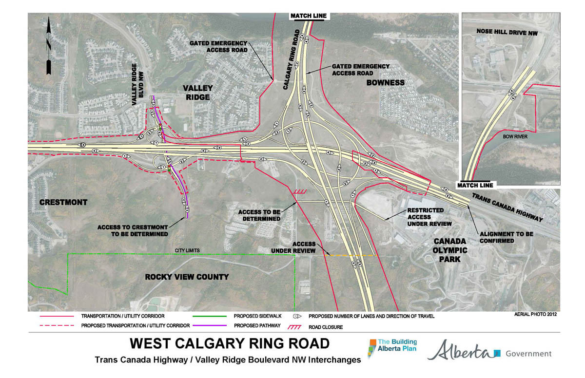
Highway 1 (Trans Canada Highway), Valley Ridge blvd NW, and the twinning of the existing Stoney Trail bridge over the Bow river:
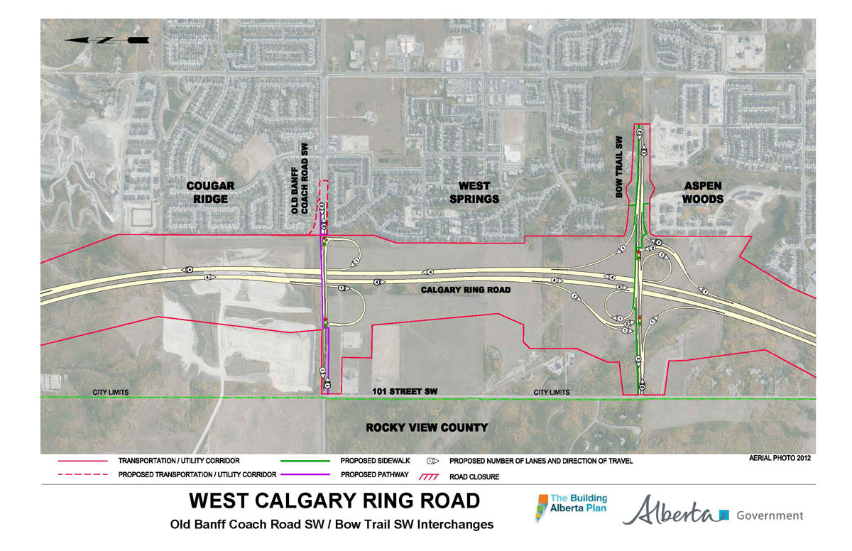
Old Banff Coach road SW and Bow trail SW:
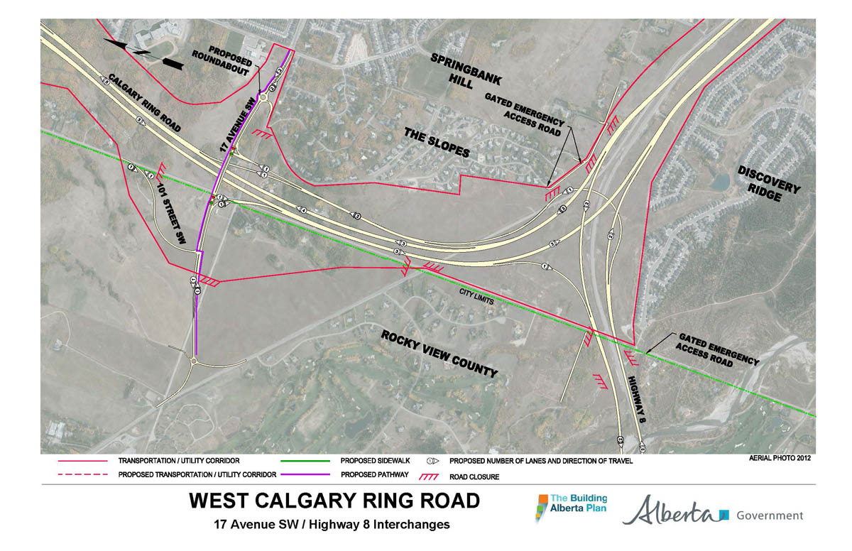
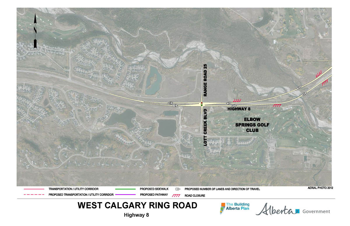
17th Avenue SW and Highway 8:
Highway 8, west of the Calgary city limits, new bridges over the Elbow river:
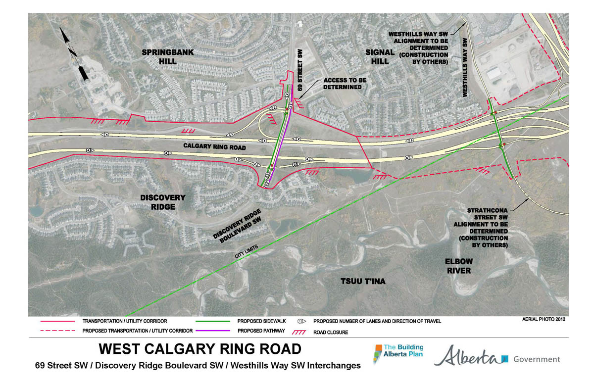
69th street SW/Discovery Ridge blvd SW:
Maps of the Southwest Calgary Ring Road (from North to South)
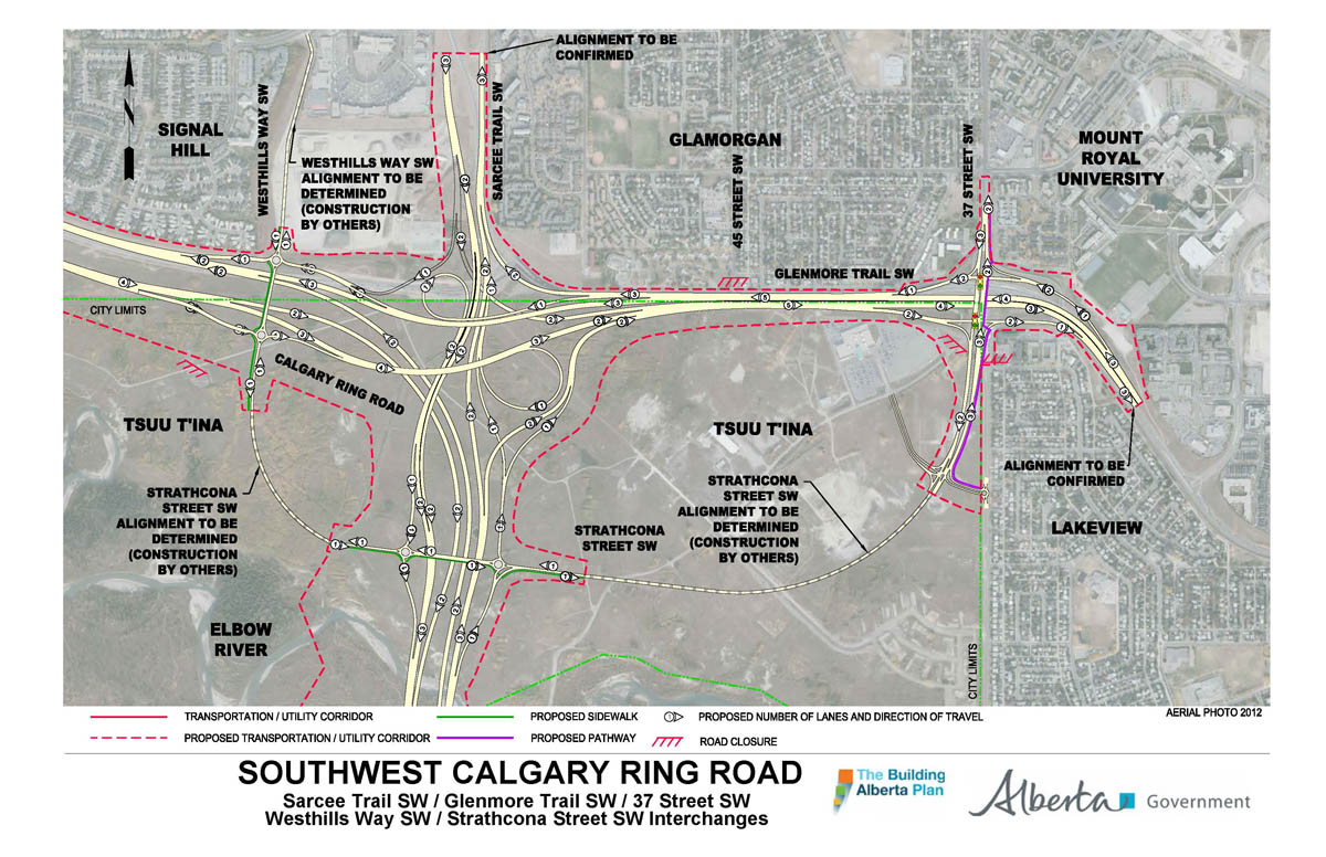
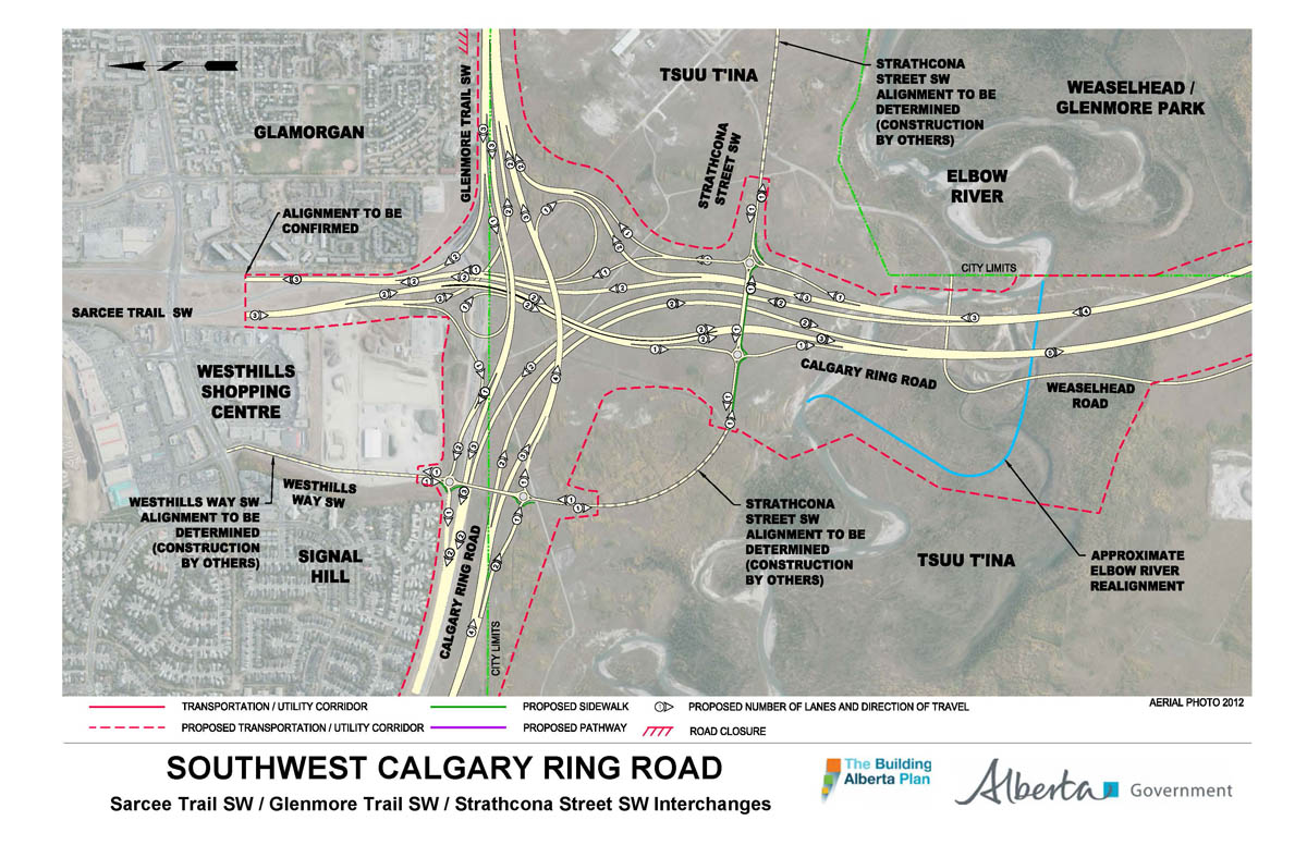
Westhills way SW, Sarcee trail SW, Glenmore Trail, 37th street SW and Strathcona street:
Elbow river crossing:
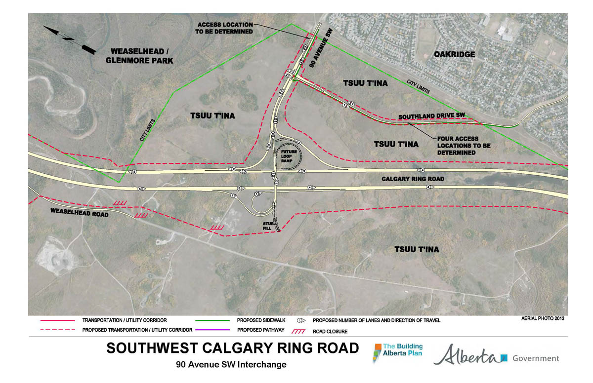
Weaselhead crossing, 90th avenue SW, Southland drive SW:
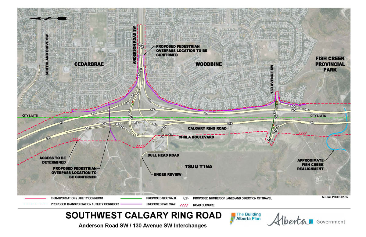
Anderson road, Chiila blvd/Bullhead road, 130th avenue SW:
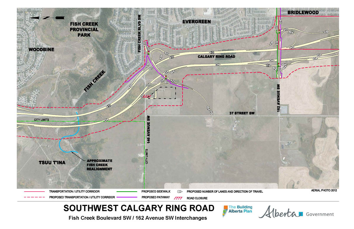
Fish creek crossing, Fish Creek blvd/146th avenue SW, 162nd avenue SW:
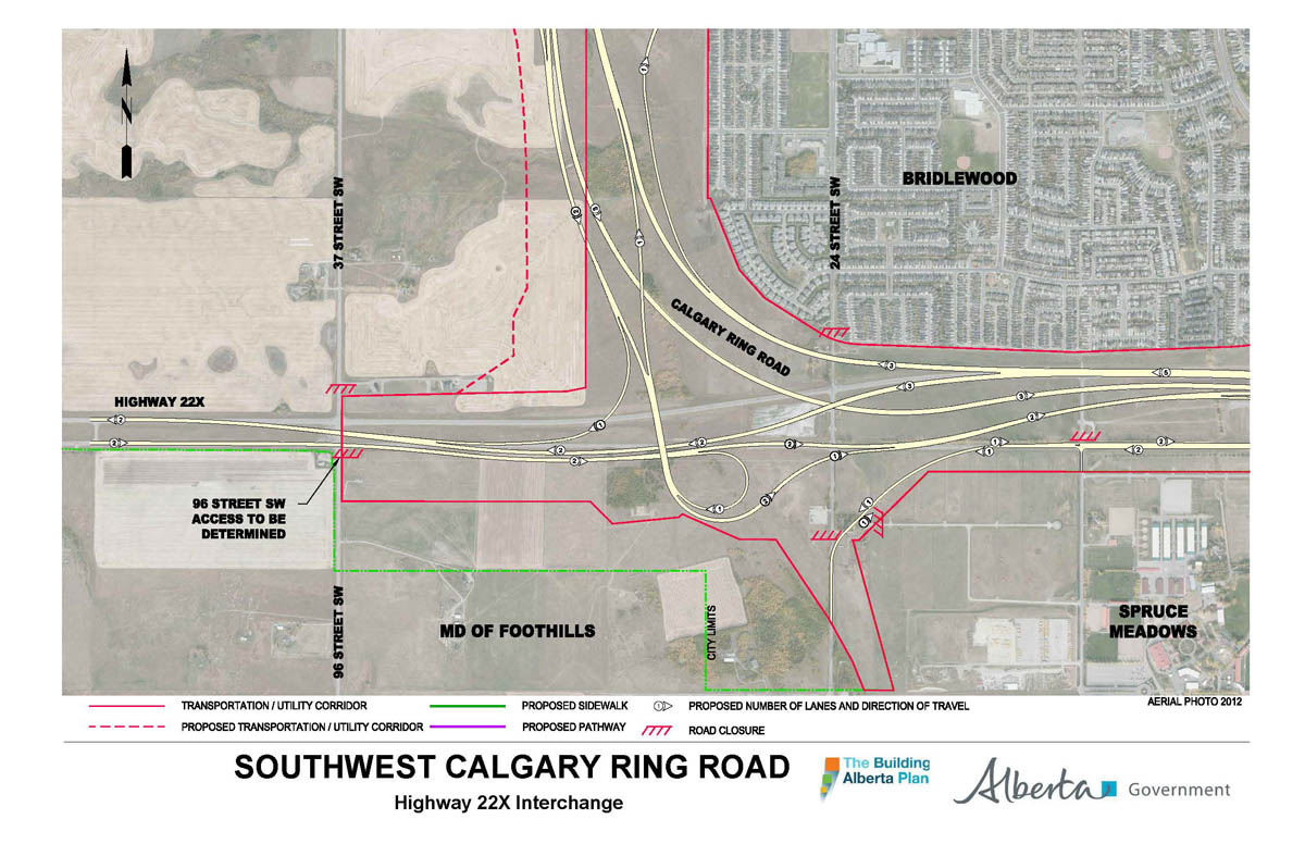
Highway 22x:
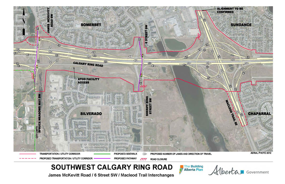
James McKevitt road SW/Spruce Meadows way SW, Sheriff King street SW/6th street SW, Macleod trail:

After seeing the maps, I now understand why the cost will be in the billions of dollars.