The Government of Alberta has announced that the west leg of the Calgary Ring Road, connecting Highway 8 to Highway 1, will be fully open to traffic as of December 19, 2023. This is the last of the five legs of the road to be constructed and opened, and marks the effective completion of the road, which has been 70 years in the making.
Calgary Mayor Jyoti Gondek speaks at the opening of the west leg of the Calgary Ring Road, along with (L-R) Transportation Minister Devin Dreeshen, MLA Eric Bouchard, Calgary-Lougheed, and Premier Danielle Smith
The Calgary Ring Road plan started life in the early 1950s, in response to a city experiencing rapid growth in both housing and in automobile ownership during the post-World War II era. Early road planning in the 1950s had at first been restricted to the City’s limits at that time, but by 1953, the plans were expanded to include the greater Calgary area. The map below, from December 29, 1953, or almost exactly 70 years ago, shows the earliest known regional road plan that includes a prototype ring road alignment (particularly evident on the west side of the city).
Untitled Map. December 29, 1953. City of Calgary Corporate Records, Archives. Board of Commissioners S.IV Box 189 f.39.
The ring road was not intended to be built when these plans were being developed, and was viewed as something that would be needed in a 30-year time-frame at earliest. A portion of the ring road was first approved to be built in the early 1980s, but an economic recession put those plans on hold. The first leg of the road, in Calgary’s northwest quadrant, would not see construction until 1995 (See The Ring Road System – Implementation for more information).
Over the following 28 years, the remaining legs of the road were steadily constructed. The opening of the west leg represents the culmination of plans that span half the life of the City of Calgary itself.
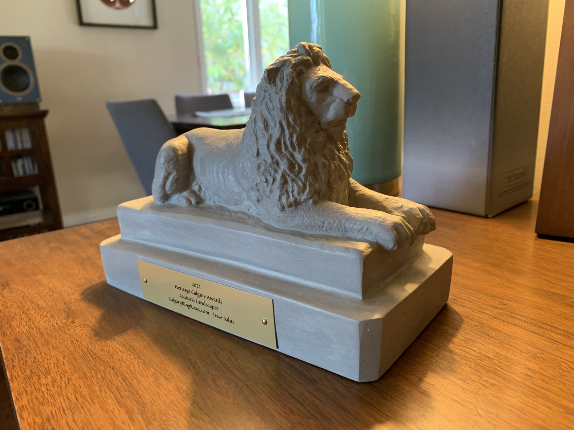
Earlier this month, CalgaryRingRoad.com was awarded a 2021 Heritage Calgary Award in the category of ‘Cultural Landscapes’. I’m grateful to Heritage Calgary and the award jury, and honoured to have been selected. Congratulations to all of this year’s winners.
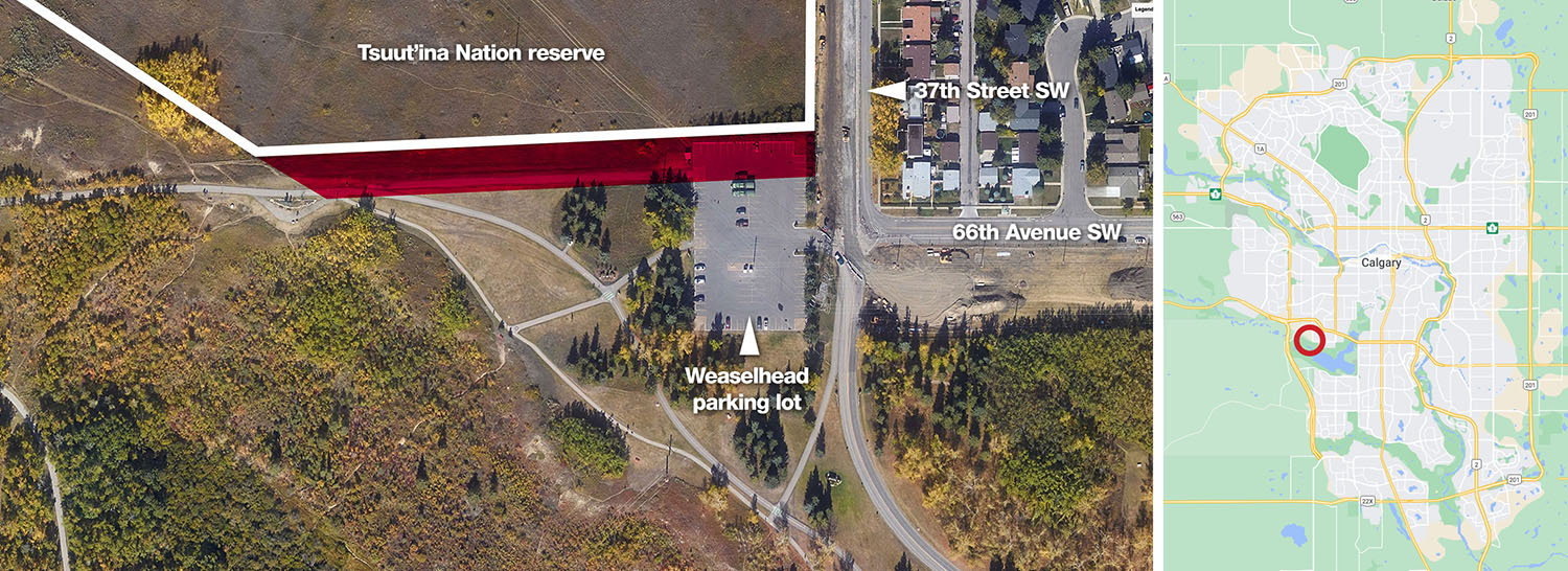
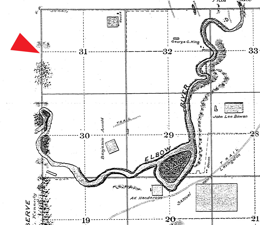
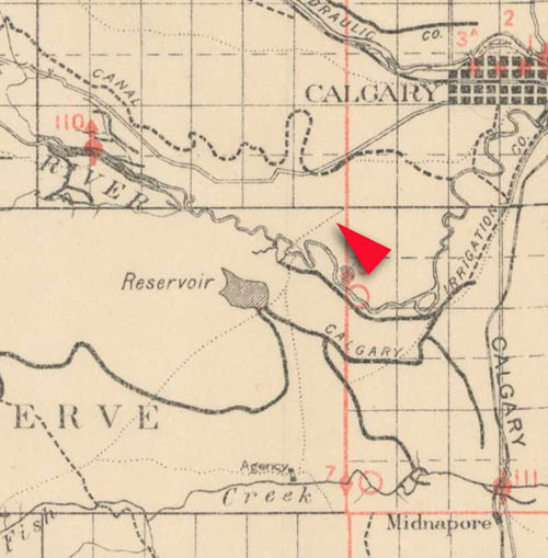
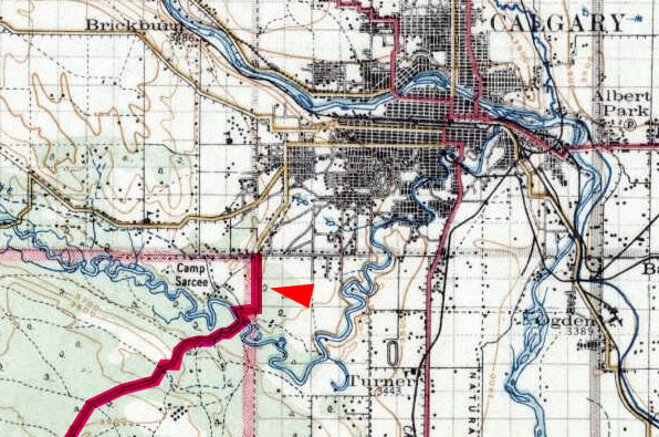
One day you may find yourself taking a walk in Calgary’s North Glenmore Park, along a pathway that connects a small parking lot to an expansive overlook of the Elbow river valley. Along that walk you would be forgiven for thinking that you were still within Calgary city limits, and that the land you were crossing was owned by the City. It’s an easy mistake to make, and it is one that has been made in one form or another for over 100 years. This unassuming land, measuring only half a hectare or 1.25 acres in area, was quietly taken from the Tsuut’ina Nation over a century ago, but continues to be claimed by the City.
The disputed parcel highlighted in red above. Located adjacent to 37th Street SW and 66th Avenue SW, in North Glenmore Park just south of the Tsuut’ina Nation reserve. Source: Google Maps. Retrieved November 22, 2020.
A close look at the history of this ‘disputed parcel’ shows an unusually complex past, and reveals the improper dealings that led to the land being removed from the Tsuut’ina Nation reserve. By exploring this story we can see the understandable, yet shaky, assumptions on which Calgary claims of ownership this land, and perhaps recognize that it may be time for it to be returned.
To understand how the City of Calgary came to ‘own’ this land, we first have to look at the history of this part of the world, and the surprising use of this disputed parcel as part of an old Provincial highway.
(I recently had a short interview with the CBC regarding the disputed parcel, it can be found here.)
Back to the Beginning
In the early years of European settlement of western Canada, homesteaders living in the Priddis and Millarville area, in what was then the North West Territories of Canada, relied on an old trail to access Calgary. This trail headed southwest from the city and crossed the Tsuut’ina Nation (Sarcee) reserve, and was reportedly in use since before the reserve was established in 1883.01 This dirt trail was not formally constructed or maintained, and suffered from chronically poor drainage; in wet years it often proved impassible for significant periods of time. As local ranchers and homesteaders relied on this route to access Calgary and bring their produce to market, the old trail was a vital link in a growing ranching district. (Read more on the history of the Priddis Trail)
The unreliability of the road was a chronic problem, and the Government of the Northwest Territories was pressed by local politicians and residents to improve the road.02 As the trail was an organically-created path that was located on Federal land reserved for the Tsuut’ina Nation, the Territorial Government wanted to acquire the right-of-way for the road before it expended any public money on improving and maintaining the road as a public highway.
1894 map showing the route of the Priddis Trail. Highlights by the Author. Source: “Preliminary map of a portion of the District of Alberta showing Canadian irrigation surveys during 1894″. University of Alberta Libraries, Peel Map 747.
Initially the matter was intended to be pursued as an expropriation of the land under the terms of Treaty 7 and the Indian Act, but the Territorial Government decided that it would be easier to instead secure a transfer agreement rather than acting unilaterally in order to take possession of the land.03
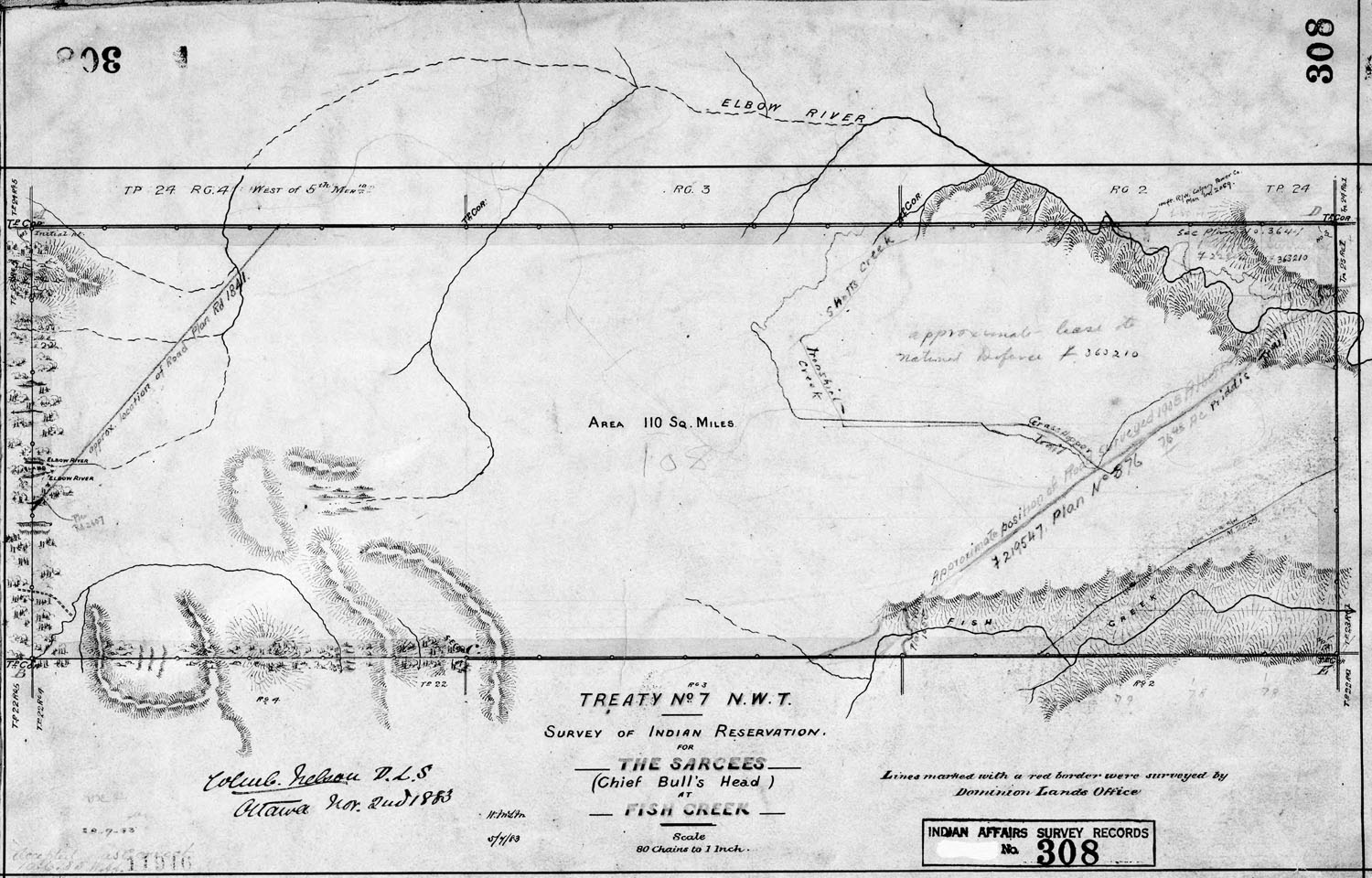
The Government of the Northwest Territories instructed its Department of Public Works to survey the road, and reached out to the Department of Indian Affairs in the spring of 1899 to seek consent for “…the transfer of the area therein contained after the survey is completed so that it may be declared a public highway.”04 That request was forwarded to the local Indian Agent to see if the Tsuut’ina Nation had any objection to the opening of the road. After discussions with Tsuut’ina Chief Bullhead, the matter was put to a meeting of the male citizens of the Nation. Informal permission was granted not only for the survey to take place, but also for the Government to improve and open the old trail as a public highway.05
“The Chief informed me the trail marked in the plan was in use by the Indians before the treaty was made with them.”
Indian Agent, Sarcee Agency. May 16, 1899.1
Securing a Surrender
In Canada, First Nation reserve land is owned by the Federal Government and reserved for a specific First Nation. Under the Indian Act, this land cannot be sold or transferred (outside of an expropriation) without the interested Nation first ‘surrendering’ their interests in that Federal land. Once surrendered, the land remains in the hands of the Federal Government until sold or otherwise disposed of in accordance with any conditions.
Over the remainder of the year 1899, the Department of Indian Affairs negotiated a formal surrender of the road corridor with the Nation. No money was offered for the land, and the Nation ultimately agreed to the Territorial Government building a road across the reserve with just two conditions.06 First, that a bridge be built over the Elbow river at the trail’s existing ‘Weaselhead Crossing’, and second was that if the Nation required the corridor to be fenced, they would not be asked to cover those costs. These conditions were agreed to by the Territorial Government, and on January 3, 1900 a surrender of their interest in the land was approved by the voting members of the Tsuut’ina Nation, a total of 21 citizens.07
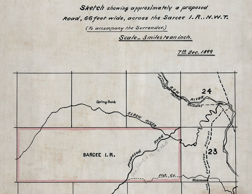
When the surrender was agreed to by the Tsuut’ina Nation, the documentation did not contain a legal description of the land being surrendered, nor did it contain a formal survey of the route. Instead, the land being surrendered was indicated on an attached sketch showing the ‘approximate’ location of the existing trail.08
Portion of ‘Sketch showing approximately a proposed road, 66 feet wide, across the Sarcee I.R..N.W.T.’ 7th Dec. 1899. Plan T192-CLSR-AB, Canada Lands Survey Records. Note that this original plan held by the Canada Lands Survey Records has been modified with a hand-written reference to the later Plan 876 completed in 1907.
The surrender of the nation’s interests in the land was soon ratified by the Privy Council of Canada, who noted that the land was to be “…surveyed and opened up by the Government of the North West Territories as a public highway…”, though interestingly no mention of a sale was made.09 A survey would be an important step in the process, as it would serve as the legal description for the land that was surrendered for the road. In fact a proper survey of the trail had already been undertaken, but a plan showing the route had not yet been prepared by the surveyor at the time of the surrender’s ratification, and was therefore not included in the documentation.
The lack of a legal land description in the surrender documentation would cause problems for those researching and transacting with this land in the future. Anyone looking to understand what specific land was surrendered in this agreement would be forced to refer to separate survey records, as the surrender itself did not contain sufficient information to determine the extent of the surrendered lands. The ‘decoupling’ of the land description from the surrender documents would create the conditions for the original agreed-upon corridor to one day be ‘lost’ and replaced with an altered route that was not part of the original agreement.
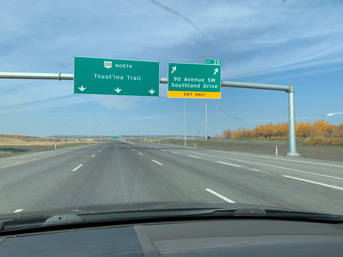
Driving the Southwest Calgary Ring Road. Northbound at the 90th Avenue SW Interchange
Today marked the official opening of a significant portion of Calgary’s Southwest Ring Road. Known as Tsuut’ina Trail, the road forms part of Alberta Highway 201 between Highway 8 and Fish Creek Boulevard SW. This opening is the culmination of a long and interesting story that spans the better part of 70 years (and beyond).
A Tsuut’ina prayer was given by Charlie Crowchild, and a safe journey song was led by Councillor Ellery Starlight to open the ceremony. This was was followed by remarks from Premier Jason Kenney, Minister of Transportation Ric McIver, Chief Roy Whitney-Onespot and Mayor Naheed Nenshi; all of whom noted the value of the road, its importance in future relations between the Nation and the City, and the significance of the long history of the project.
L-R: Alberta Minister of Transportation Ric McIver, Tsuut’ina Chief Roy Whitney Onespot and Calgary Mayor Naheed Nenshi
An unscheduled speaker, Seth Cardinal Dodginghorse, took to the podium during the ceremony in order to provide an alternative view of the project. He spoke about the loss of his childhood home and of his family having to move from the land that was required to build the ring road, after which he cut off his braids as a sign of protest.
Following the ceremony, drivers were allowed to traverse the new section of the road. These first travelers on Tsuut’ina Trail headed north from Anderson road past the 90th Avenue SW interchange, through the Weaselhead area and over the Elbow River before passing the Tsuut’ina Parkway interchange and then on to Glenmore Trail. A journey of around 4 minutes going the posted 100km/h limit.
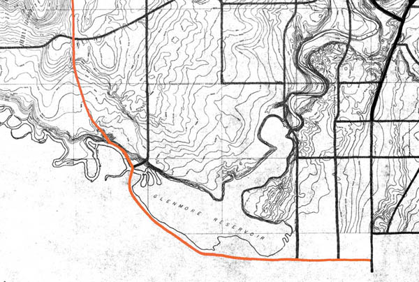
Half as old as Calgary
The origin of this road dates back to 1952 when the City first envisioned a bypass road located west of the Glenmore Reservoir. The timing is notable, as 1952 marks the halfway point in Calgary’s life; 68 years after the establishment of Calgary as a town saw the emergence of what would become the Southwest ring road, which was then opened 68 years later.
In 1952 the road was only hinted at, and it wasn’t until the following year that a bypass route was actually committed to paper.
(Source: Untitled Map. December 1953. City of Calgary Corporate Records, Archives. Board of Commissioners S. IV box 189 F. 39. Highlight added to show the southwest bypass route.)
This route would be altered over the years, sometimes significantly, but some variation of a Southwest Ring Road has continued to feature in the City’s long-term planning ever since.
Now Open… Mostly
With the Tsuut’ina Trail segment of Calgary’s Ring Road open, only the portion of the Southwest leg between Fish Creek Boulevard and Highway 22x, and the West leg between Highway 8 and Highway 1 remains under construction.
Although it has been nearly 70 years in the making and is now largely open, the story of the Southwest Ring Road is only just beginning. Tsuut’ina Trail will act as a link between the City and the Tsuut’ina Nation long into the future, not only physically, but also with the potential to bring together two communities in culture and commerce.
UPDATE: This presentation is now fully-booked. Thank you to all who want to come, and I will see if there are other opportunities to present on this topic in the future.
Next month I will be presenting at the new Central Library. The discussion will focus on one particular facet of the history of the broader ring road story; the long history of actions to acquire or assert control over Tsuut’ina Nation reserve lands, from the 1880s to today. Please join me for the talk and a Q &A session after.
Thursday, Sept. 26. 7:00 – 8:30 p.m. Calgary Central Library, 800 3 St SE
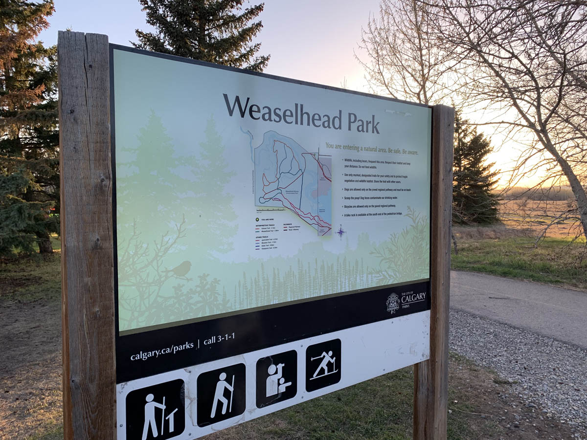
The Weaselhead Flats park is a 593.5 acre area of the Elbow River valley upstream of the Glenmore Reservoir in Southwest Calgary. The first recorded mention of the name ‘Weaselhead’ in relation to the Elbow river valley dates back to the 1890s, but where did the name originate? Why do we call this park, and the rest of the valley within the Tsuut’ina Nation reserve, ‘Weaselhead’?
There are a number of explanations for the origin of the Weaselhead name, and while some details may never fully be known, we can begin to learn the story of where the name came from, and how the area came to be known as the Weaselhead.
Conflicting Origin Stories
The City of Calgary acknowledges that the origin of the name of the Weaselhead Flats park is unclear, but points to the idea that the area was named after a Tsuut’ina man named Weaselhead. According to the City, the area is “…likely named after the Tsuu T’ina Chief Weaselhead who was in power at the time of European contact.”1
However, this isn’t the only origin story regarding the Weaselhead name; there is an alternative explanation known within the Tsuut’ina Nation which proposes just the opposite. In this version, Weaselhead was not Tsuut’ina, but a con-man from another Nation who was murdered along the banks of the Elbow river when his criminal ways caught up with him. According to this retelling, the name Weaselhead was then given to the area as a cautionary tale against adopting such a lifestyle.2
Clearly both cannot be true, and there is enough evidence that would suggest that perhaps neither is exactly right. Both stories say that Weaselhead was a man, but what do we know about this man, and how did he come to lend his name to this part of the Elbow River? Continue reading “Finding Weaselhead”
Why was the SW ring road planned through a First Nation’s reserve? How did the Weaselhead come to be owned by the City of Calgary? Why are Unexploded Ordnance being found in the Elbow river valley?
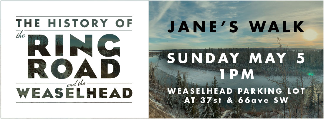
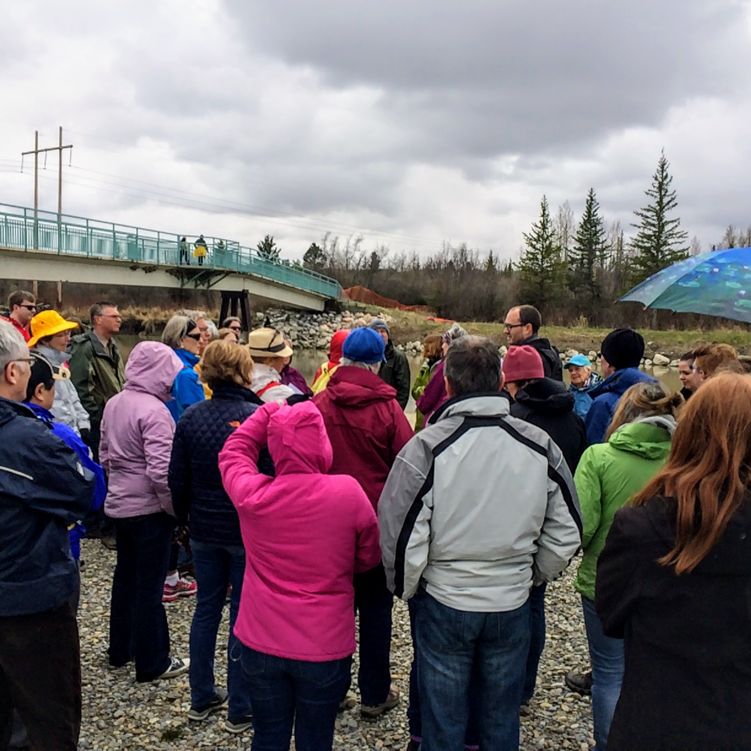
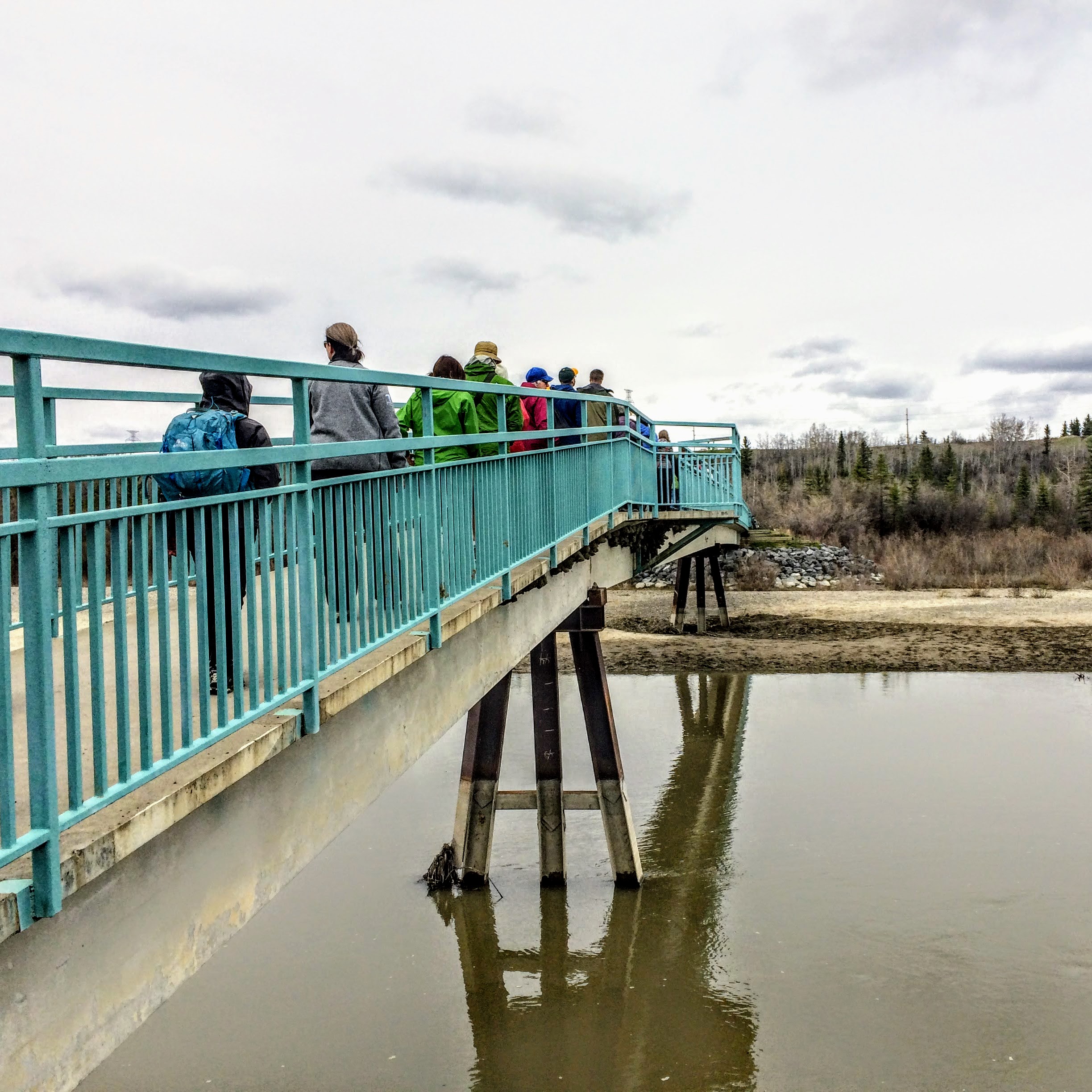
Join me again on this year’s Jane’s Walk through a beautiful and historic part of Calgary.
This is the fifth year that I will be leading the walk, and it will be a chance to talk about many of the issues I have covred on this blog; to look at the history of the SW Ring Road and to explore the past, present, and future of the Weaselhead area, one of the most historically rich parts of Calgary.
We’ll travel along the first Provincial highway that was built through the Tsuut’ina Nation reserve over 115 years ago (with origins dating back even before the signing of Treaty 7) and through land that was purchased in the 1930s for the Glenmore Reservoir. We’ll see where the Canadian Military operated the largest WWI training camp in Western Canada, and explore the legacy of disputed land ownership and unexploded ordnance that years of military use has left behind. We’ll experience one of the quietest corners of the city, now adjacent to where the SW Ring Road is being built, and see where previous plans would have located the road through the valley. We’ll look at the role that the Tsuut’ina Nation’s economic development plans have played in getting the road approved, and how Calgary and the Nation can come together as development progresses.
Details
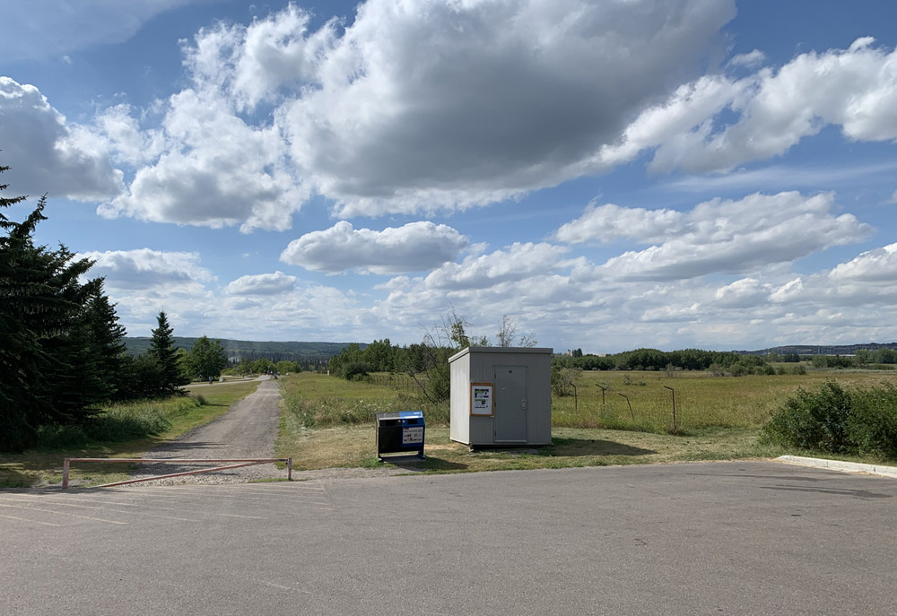
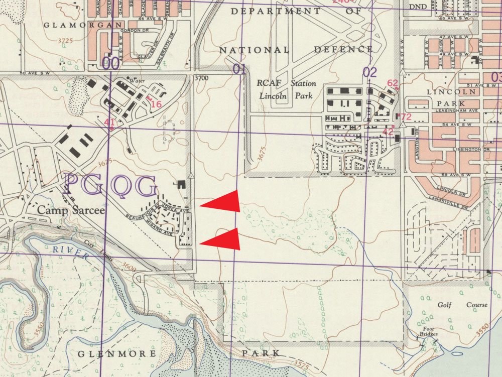
Date: Sunday May 5, 2019 Time: 1:00 pm Duration: about 2.5 hours Meeting Place: North Weaselhead Parking Lot (at the corner of 37th street SW and 66th avenue SW in Lakeview)
Don’t forget to download the handout to your smartphone for the walk! Download here
Although construction of the Southwest Calgary Ring Road has been ongoing for the past few years by the KGL Constructors partnership, it is not always easy to see what progress is being made. A large portion of the road is located on former Tsuut’ina Nation reserve land which isn’t accessible or visible to the average Calgarian, and as such, getting a sense of the work being done on this project can sometimes be difficult.
Last fall, Reddit user ‘Craftyshrew’ flew over Southwest Calgary and captured an image of the ring road project from the air. The cleared land along the route carves a visible corridor through the former reserve land, where the scale of the project, and the progress of construction, can be seen.
(Image looking north from about Highway 22x. Click image for larger version)
At this stage in the project, construction has begun to some degree on all 14 of the interchanges along the Southwest Calgary Ring Road route, and grading for the mainline ring road lanes is approximately 45% completed. Bridge pilings have been started on many of the interchanges, with the rest commencing as the 2019 construction season begins.
Construction of all interchanges will continue into 2020, when the majority of the paving will be undertaken. The southwest portion of the ring road is scheduled to be open to the public in the fall of 2021.
Thank you to Craftyshrew on reddit for their kind permission to publish their photo, and to Adam Johnson and Rizwan Hussain from Alberta Transportation.
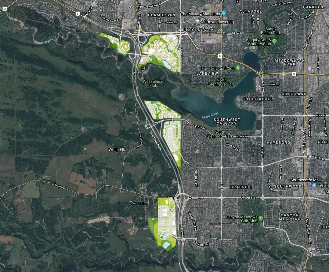
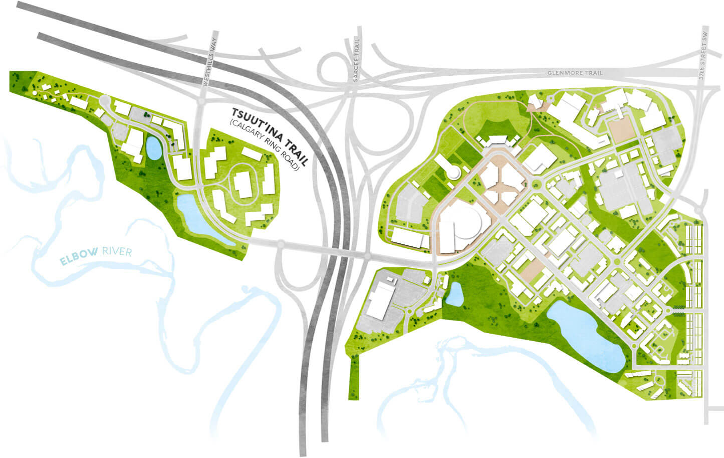
I have recently had the opportunity to work with the Tsuut’ina Nation-Canderel Development Partnership on some design and communications work, including the website for their upcoming Taza development. I’m pleased to see the launch of the ExperienceTaza.com website this week, which provides information on this transformative First Nations project, located right on the edge of Calgary.
EDIT February 22, 2020 – The ExperienceTaza website has been replace with the new TogetherAtTaza.com website.
EDIT December 2019 – The first tenant announced for the project is a new Costco, part of “The Shops at Buffalo Run” development located within in the Taza Exchange area near 130th avenue SW.
Taza is a series of three commercial development areas, or ‘villages’, that are located on the eastern edge of the Tsuut’ina Nation reserve. From north to south, Taza Park, Taza Crossing and Taza Exchange are connected along a 9km portion of Calgary’s Southwest Ring Road, known as Tsuut’ina Trail where it crosses the reserve. The name ‘Taza’ is a Tsuut’ina word for an expression of amazement, and the development has adopted the tagline ‘Together at Tsuut’ina’.
The Taza development is a joint-venture between the Tsuut’ina Nation and the development company Canderel, and represents the culmination of nearly 50 years of economic development and planning by the Nation. For the story on the early years of the Nation’s economic planning, click here.
Click on the maps in the following sections for a larger version of each.
Taza Park
Taza Park is a 530-acre parcel of land located on Glenmore Trail that was previously home to the Harvey Barracks Military base. The ring road bisects Taza Park into two parcels, and the development area extends from the community of Lakeview on the east to Discovery Ridge on the west.
Access to the site is provided by three primary interchanges at 37th street SW and Glenmore Trail, at Tsuut’ina Parkway at Tsuut’ina Trail and at the new Westhills Way. Secondary access is also planned at several existing roads along 37th street SW that were originally built to provide access to the former military base.
The area is touted as a “dynamic recreation and entertainment destination” and consists of a mix of retail, dining, residential, recreational and cultural amenities. Taza Park interfaces with the existing community of Lakeview with a new lower-density residential area on the west side of 37 street SW.
The plans also feature a ‘pedestrian-friendly Market Street’, and includes a network of cycle paths, parks and artificial lakes and ponds, much of which is located overlooking the Elbow river valley and the Weaselhead area. Continue reading “Taza Revealed”
What follows is a short historical overview of the history and use of 37 Street SW in the community of Lakeview in Calgary. The road has a surprisingly long and interesting history, with a long tradition of First Nations, Military and Community use of the corridor since it was first set aside as a road.
In 1883 the Tsuut’ina Nation reserve was first surveyed and reserved for the Nation, shown below.
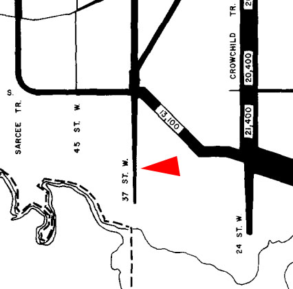
The same year the adjacent township was surveyed, dividing up what is now SW Calgary. This survey laid out the 66-foot-wide 37 Street SW road allowance for the first time. The arrow on the survey below indicates the road.
When the reserve was first created, the Tsuut’ina Nation established a trail through the reserve to access Calgary at what is now 37 Street SW and Glenmore Trail. This route was part of a trail known as the Priddis Trail. The map below from 1897 shows this trail.
In 1900 the government formalized that trail into a highway through the reserve, and moved the reserve entrance to what is now the Weaselhead parking lot at 37 Street SW and 66 Avenue SW. Accessing the reserve meant traversing one mile of 37 Street. Below is a map from 1926 showing route of the Priddis Trail.
For a brief time in 1930 the Priddis Trail, including that portion of 37 Street SW, was earmarked as the route of Highway 22, before ultimately being built from Midnapore.
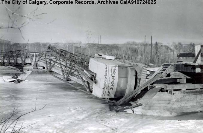
The Priddis Trail served the Nation and Calgarians for 58 years, until the bridge over the Elbow collapsed in 1958 (pictured below). Nation citizens had already been using the Military’s new bridge, which was constructed around 1950 over the Elbow river, and returned to using the old reserve entrance point at the intersection of Glenmore Trail and 37 Street SW.
The Military built several more roads in 1957-58 that connected to 37 Street SW to allow access to Military housing and a school on the west side of the road. At this point in time, access to the Military base, the Tsuut’ina Nation reserve and a cattle ranch are the primary uses of 37 Street SW, and construction of Lakeview had not yet been started. The map shown below is from 1960.
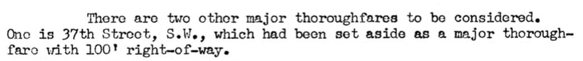
When planning for the new community of Lakeview began in 1959, the City of Calgary designated 37 Street SW as a ‘Major Thoroughfare’ and added 34 feet to the width of the road’s original corridor.
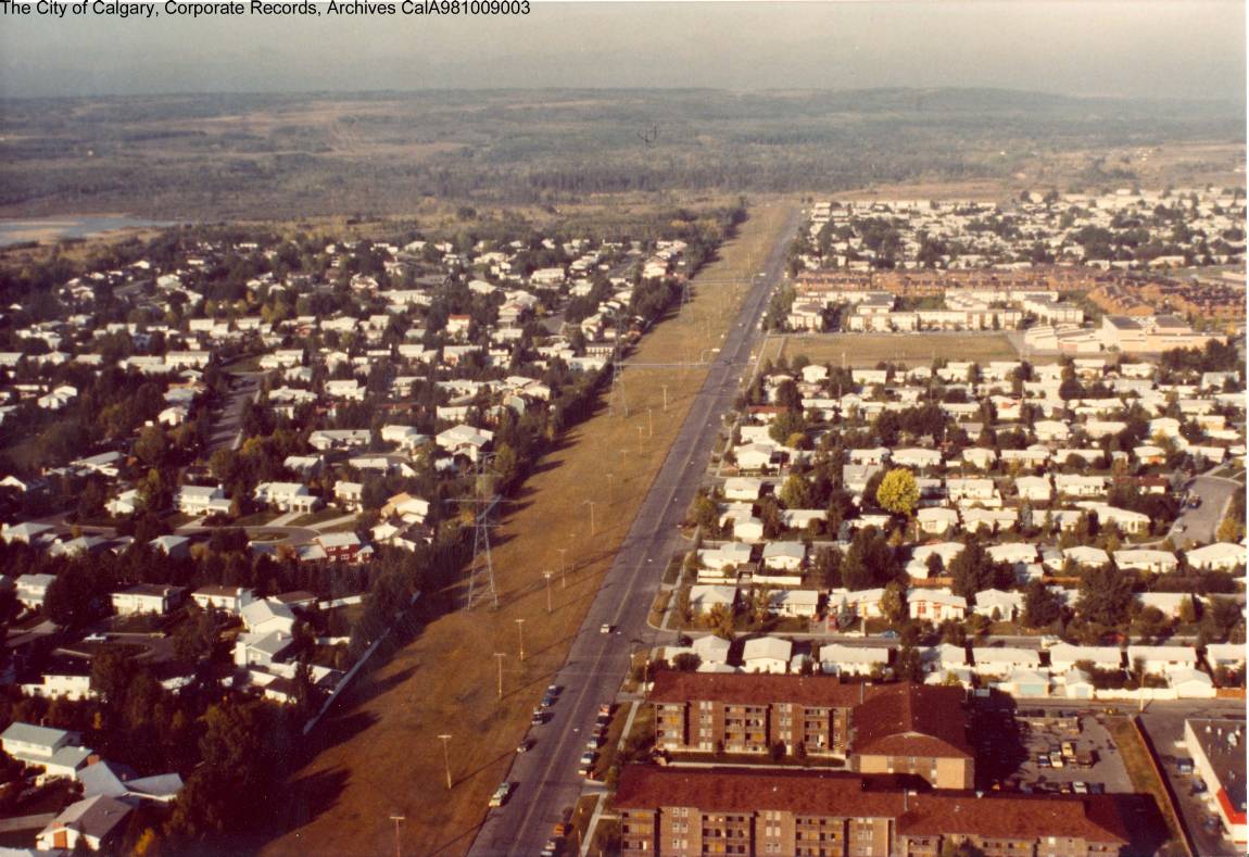
In 1960, construction began on the neighbourhood. The first houses were built on the east side of the community, near Crowchild Trail. Over the next decade construction moved west, closer to the newly-paved 37 Street SW, and the final phase of Lakeview’s original single-family homes were built in 1968-69. Below is a picture of Lakeview from the 1970s, looking west along 66th Avenue SW.
In 1970, after much of Lakeview is largely completed, traffic maps for the first time show traffic on 37 Street SW. About 5,000 cars per day are shown on the road near Glenmore Trail, with the numbers dwindling lower towards the south end of the road. The change of the road from rural right-of-way into suburban thoroughfare marks the most significant change in the use of 37 St SW in the history of the road. Traffic on 37 Street SW was at its peak in the 1970s, when Military use, Lakeview access, and users of North Glenmore Park constituted the majority of traffic. In the 1990s the Military base was closed, and traffic has declined overall since that time. The City of Calgary’s traffic map from 1970 is shown below.
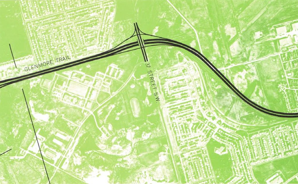
In 1967 the City of Calgary had already planned for the 37 Street SW – Glenmore trail interchange to be a ‘diamond’ style interchange when conditions warranted it. The plan from the City of Calgary’s 1967 CALTS report is shown below.
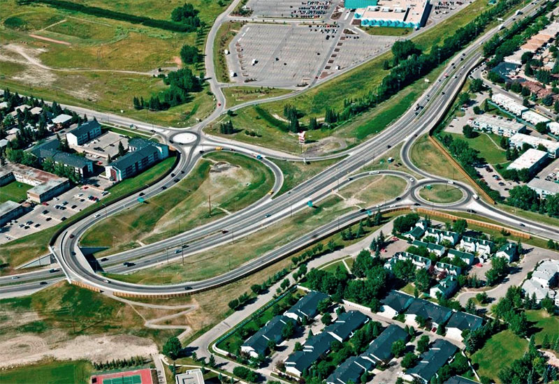
In 2010 a new temporary interchange was built at 37 Street SW and Glenmore Trail. The interchange was designed so that the bridge over Glenmore Trail was located away from where a permanent interchange would eventually be built. This would allow the interchange to remain open while a new interchange was being constructed. The current interchange is shown below, looking towards the Southwest.
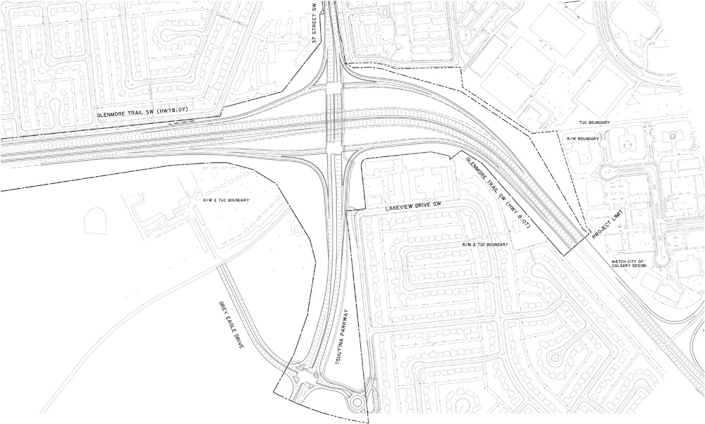
In 2013 the Province of Alberta and the Tsuut’ina Nation entered into an agreement to sell land for the Southwest Calgary Ring Road. This agreement guaranteed access to the Tsuut’ina Nation reserve at 37 Street SW and Glenmore Trail as part of the ring road project. If this access is not provided, the ownership of the entire ring road corridor through the reserve will revert back to the Nation. The design of the new permanent interchange is shown below.
The contract for construction of the ring road project including the new interchange at 37 Street SW and Glenmore Trail was awarded in 2016, and some initial earthworks has already begun. The interchange is set to open by 2021.