
Though the planning for a Southwest Ring Road had been started in the early-to-mid 1950s, it remained little more than a line on a map for the next few decades. It took the pressures of growth, and the establishment of a new Provincial park, for the City to move the project from long-range thinking to a more detailed phase of planning. By the mid 1970s the planning for the Sarcee Trail extension, as it was then known, had become a priority to the City, even if the need for the road was recognised to still be decades away.
The study would look at routes that traveled from Glenmore Trail to Highway 22x, though I will focus on the portion that crosses the Elbow River, from Glenmore Trail to Anderson Road. For more on the crossing of the Fish Creek, see here.
Midnapore and the Fish Creek Park
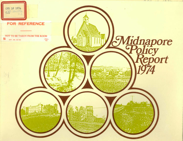
In 1974 the City of Calgary began to plan for the development of the area south of Fish Creek known as Midnapore. At that time the Province was in the process of establishing the Fish Creek Provincial Park, and the potential for the park to isolate the Midnapore area from the rest of Calgary prompted the City to assess the utility and transportation requirements needed for future development. Although development of Midnapore was still years away, the establishment of Fish Creek Park highlighted the need to coordinate plans for both, so that the Province and the City would understand and take into account how both developments would affect each other.
The Midnapore Policy Report, approved by Council December 9 1974, had outlined several options regarding the development and growth of the area, though all had the same transportation requirements; in addition to the existing Macleod Trail and the planned Deerfoot Trail, the Midnapore area was to be serviced on the west side by Sarcee Trail. In fact, not only was the Sarcee Trail planned to serve the area, Midnapore’s growth and development potential was actually contingent on the construction of this road, and without this it, development would be capped far below what the land was capable of accommodating.
In approving ‘Option C’ of the plan, the City council also passed a resolution that read “…that the Transportation Department be instructed to proceed with a study of the Sarcee Trail extension from Glenmore Trail south to Highway 22(x) and a study of those routes linking Sarcee Trail to the downtown…”
This directive, and the money allocated from the 1975 budget, set the stage to begin formally assessing the various potential routes that the Sarcee Trail extension could take, and which of those routes was the most suitable for the road. (For more information on Midnapore and it’s role in the Ring Road story, click here)
Initiating the Study
Even before the City Council approved the Midnapore Policy Report and sought a study for the location of Sarcee Trail, the Transportation Department had initiated preliminary work on locating the road’s corridor. In November of 1974 the City wrote to the Calgary Field Naturalist Society (CFNS) to solicit feedback on five initial routes that had been prepared, under the caution that “very little engineering” had gone into them. This contact was a prelude to the initiation of the full study, set to begin in 1975.
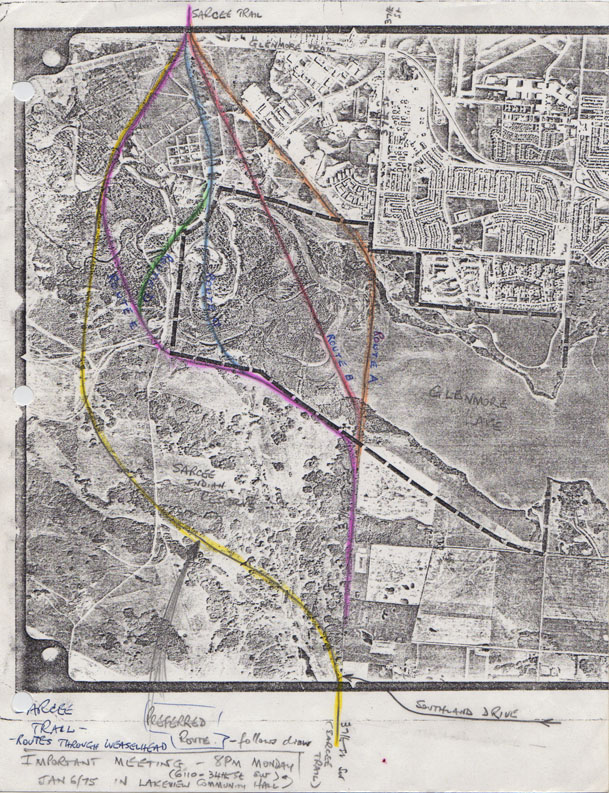
On January 6 1975 the Lakeview Community Association, along with members of the CFNS, held an information session to help inform local residents about the road proposals and the upcoming study by inviting representatives from the City to discuss their preliminary options for the road. The public nature of the meeting appears not to have been communicated to Senior Transportation Design Engineer Doug Leibel, as he later stated that ‘the Lakeview meeting was a bit of a surprise to me since the invitation indicated that it was to be a brief meeting with the Lakeview Community Association executives…’. Nevertheless the well-attended meeting was an animated and at times heated public discussion; one that was seen as informative, but also noted for punctuations of ‘noisy, door-slamming adolescence’ with a ‘mixture of passion and intolerance’.
Despite this, those active on the Lakeview Community Association board and the CFNS were willing to engage the City in a more productive manner. Dave Matthews, a member of both organisations, joined the process of citizen engagement on the Sarcee Trail issue early by drafting a new route in addition to the five already prepared. This unsolicited proposal would see the road pushed further west and south than the other proposals suggested, away from the Weaselhead. Rather than being simply the wishful thinking of a local resident, significant elements of this route (shown below in yellow) would later form part of the foundation for the recommended option for the Sarcee Trail alignment for decades.
Citizen Design Team
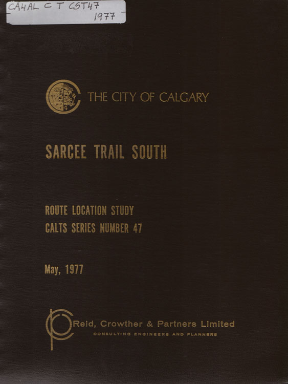
The Lakeview meeting was seen by the Transportation Department as the beginning of community consultation on the project, specifically regarding the creation of a Citizen Design Team. This study, like several others that took place in the 1970s, would utilise a collection of citizens from a cross-section of affected communities and organisations in order to feed back into the proposed designs for the road. With the study awarded to the consulting engineering firm of Reid, Crowther and Partners Limited, the Citizen Design Team was ready to be assembled. Representatives from communities like Lakeview, Oakridge and Midnapore were invited to participate, and were joined by representatives from non-community groups like Calgary River Management, the Canadian Independent Truckers Association and the Alberta Motor Association, among others. The team members were encouraged to raise concerns that might arise from their organisations; to suggest alternatives and to provide feedback to the engineers who were responsible for the technical design of the road. Senior Transportation Design Engineer Doug Leibel even stated that the citizen team would ‘have the option of telling council point-blank it doesn’t want any road at all’, though this did not happen.
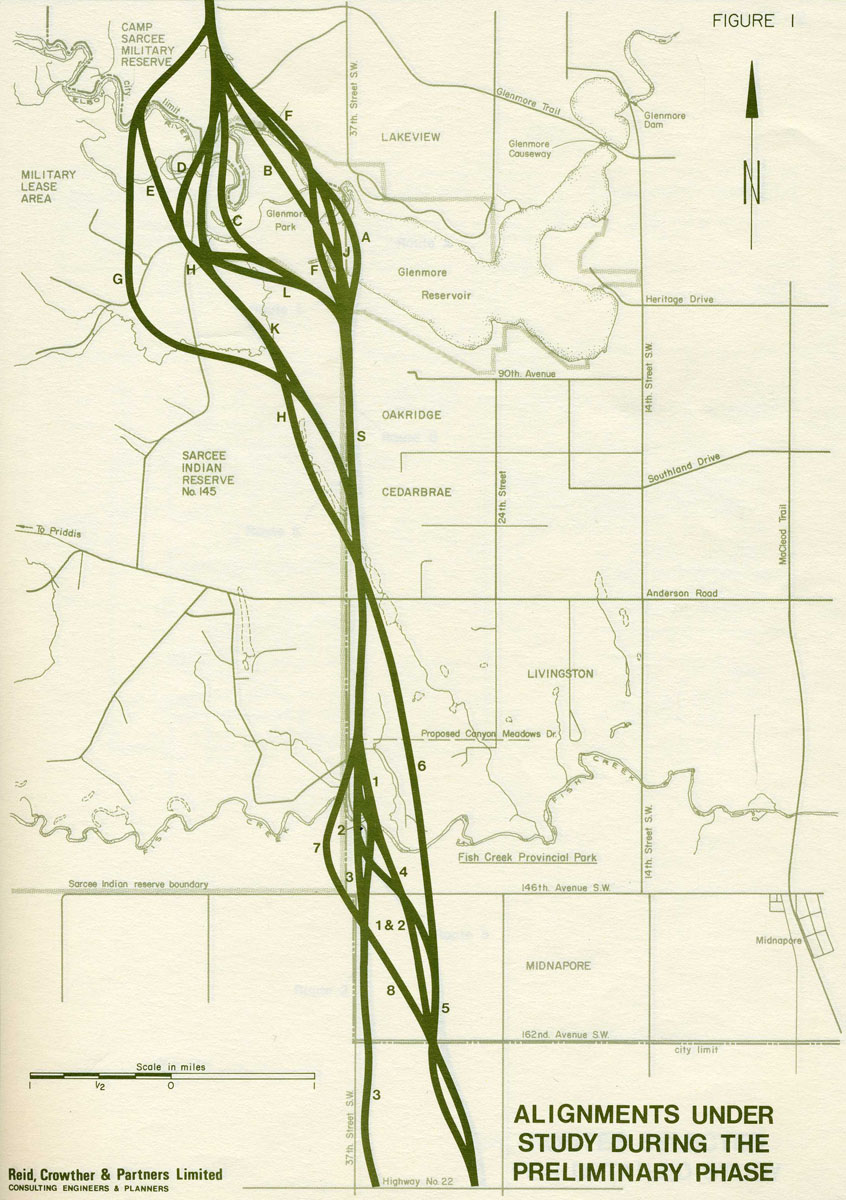
In the course of the meetings, the original five proposed routes was increased to at least a dozen routes selected for study (shown above), though this number would be greatly reduced through engagement with the Citizen Design Team by the time the study was completed. In all, five or six Citizen Design Team meetings took place between April and December of 1975, including a field-trip to the potentially affected parts of the Glenmore/Weaselhead park.
Route Selection
The newly expanded selection of routes were assessed on various criteria, which included impacts on recreation, biology and noise, disruption of military facilities, route length, requirement of Tsuut’ina lands, and others. Noting a general dissatisfaction with the routes that cut directly through the centre of the Weaselhead, many of the routes were dropped, retaining only three; those that skirted the edges of the Weaselhead. These three routes between Glenmore Trail and Anderson road (shown below) remained the recommended routes, though the study was unable to recommend a single final alignment as was hoped at the outset.
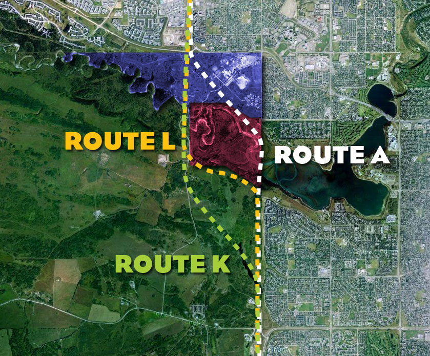
Route A would have traversed the east side of the Weaselhead via a low-level causeway and was contained entirely within the city limits of the time, while Routes K and L were located partially on land in the reserve. The location of these two routes would create a difficulty for the study: the availability of reserve land and other data from the Nation had not been collected or definitively assessed in the course of the study, and further information would be required in order to recommend a final route.
Tsuut’ina Involvement
The Tsuut’ina ended up playing a significant role in the study, despite only being involved in the periphery of the process. Plans for the SW ring road from as early as 1956, which represented some of the very earliest plans for this road, had noted the potential need for some land from the Tsuut’ina reserve. During the 1950s and 1960s, that requirement was largely dropped in favour of routes that would only cross land within the city limits, and while routes that required Tsuut’ina lands were still being studied, none had been approved at that time.
At least two of the five initial routes presented by the City in 1975 in preparation for the Sarcee Trail study traversed a portion of the reserve, and these would be joined by others like Routes K and L. The inclusion of Tsuut’ina-based routes would appear to have been optimistic, as very early on in the study process the Nation had publicly noted that a deal for reserve land may never happen. In an interview in January of 1975, only 2 days after the Lakeview information session, Tsuut’ina Chief Gordon Crowchild said that while the band council would be willing to listen to a proposal, they would not be likely to sell the land required for the road.

Representatives from the Nation had been invited to participate in the Citizen Design Team, but this offer was not taken up. Wary that their participation in the process to select a route might be construed as an endorsement of a Tsuut’ina-based alignment, the Nation elected to send representatives to attend a few meetings in a more passive capacity. One of the Tsuut’ina representatives noted in the first meeting of the Citizen Design Team that he had been instructed to attend, but would not comment until he had reported back to the Nation with information from the meeting. In subsequent meetings, Chief Crowchild reiterated comments made in newspaper interviews at the time; that any land sale was not likely to be ‘easily resolved’, and while they would be willing to talk about a land deal, the issue was a significant one for members of the Nation.
In Need of Further Study
Following the conclusion of the Citizen Design Team meetings, but prior to the study being finalised, the Tsuut’ina had stated their desire to conduct their own study. Concerned that the Sarcee Trail South Route Location Study considered only the needs of the city, there was a desire to assess the road from the perspective of the Tsuut’ina. For example, the road as detailed in the study included access to the reserve only at the existing point at Anderson Road, and looked to provide no further access, and thus no further long-term benefits to the Nation beyond any payment or land transfer for the right-of-way. An independent study, reportedly aiming to interview every Nation resident in person, was meant to evaluate the impacts that the road would have on the reserve and look at the possible ways in which a road could provide a benefit to the Nation. Noting that such a study was of value in assessing the recommended routes, the Calgary City Council supported the proposed Tsuut’ina study, and pledged $40,000 towards the cost of the study.
The City’s study concluded without selecting a final route to advance to a Functional Planning Phase because the final decision of where to locate the road would depend on the Tsuut’ina agreeing to negotiate. In order for that to happen, it was felt that the Nation would need a compelling reason to consider a deal. It was hoped that an independent study that endorsed a road through the reserve would move the project forward, though this would prove to take longer than expected.
Despite some early movement towards initiating a Tsuut’ina-focused study, that process never materialized, and it would not be until the early 1980s that a new study of the road would be undertaken to fulfill that mandate. That study, the Sarcee Trail Planning Study published in 1984, is discussed here.
Unfinished Business
When the Sarcee Trail South Route Location Study was concluded and published in 1977, it was not adopted by City Council as many other transportation studies were, but rather it was accepted as information only. Though the study was hugely important in assessing and eliminating potential routes, without a finalized alignment, and without an agreement to negotiate with the Tsuut’ina, progress on the project would have to wait.
—–
With thanks to the Lakeview Community Association, Citizen Design Team member Dave Matthews, and to Robert Dickinson and Jason Booth from the City of Calgary.
