The release of a ‘virtual tour’ video of the Southwest Calgary Ring Road this past week has given the public a chance to view the proposed plans for this road in a way that maps have not been able to. The detail and context provided by the video has raised concerns over the impacts the road will have on southwest Calgary, including the Elbow River, Fish Creek and the Weaselhead. The nature, size and proximity of the cut-and-fill river crossing, combined with a realignment of the rivers, appear to be at the heart of these concerns.
(Source: Alberta Transportation)
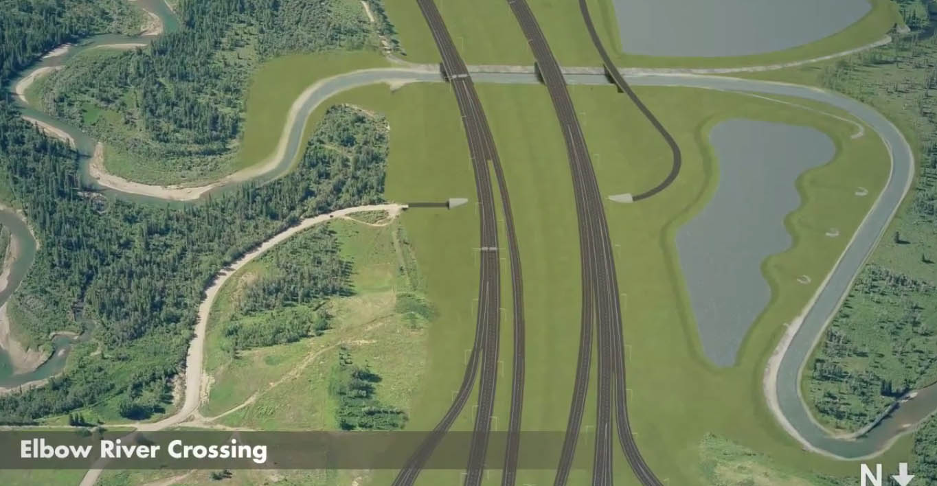
The crossing of the Elbow river is arguably the most important link in the Southwest Calgary Ring Road project. This new crossing of the Elbow river in southwest Calgary, the first since the Glenmore causeway opened in 1963, is projected as being the single most utilized portion of the new road. Establishing this crossing has seen numerous proposals over the years; from a low-level bridge in the 1950s to a dam in the 1980s (creating a new reservoir upstream from the Weaselhead) to a consideration of a high-level bridge, and even talk of a tunnel, in the 2000s. A new crossing of the Elbow river is an idea that has undergone many revisions and alternatives in the decades since it was first proposed.
The first part of this story looks at the early proposals and the history of the crossing of the Elbow River, from the first proposal in 1956 to the project’s (temporary) cancellation in 1986. Part two, which looks at the modern river crossing plans and alternatives from 2000 to 2014, will follow.
Early plans: models and maps
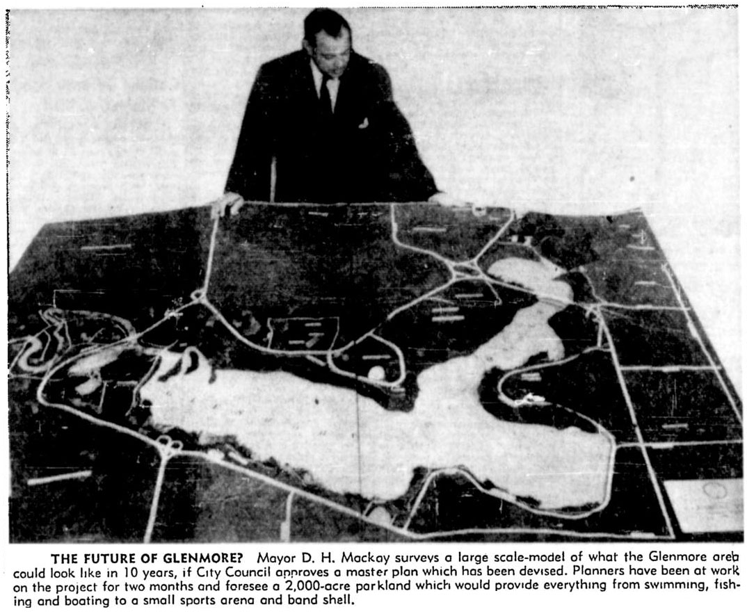
In 1955 the Province of Alberta made public its desire to establish a bypass highway in Calgary’s southwest, and by the following year, the City had drafted initial plans for this road. Around the same time the City was also developing plans for the Glenmore Reservoir parks, and these two proposals would converge in the form of the first publicly released concept for the Southwest Ring Road, then known as the West Bypass, and its crossing of the Elbow river.
The ambitious plan for the proposed Glenmore Parks, containing an aquarium, a solarium, botanical gardens, an ‘Indian Village’ and more, was estimated to cost $3 million and would take upwards of 25 years to implement. When the City’s planning department was seeking approval from both the public and the City Council for the proposed park system surrounding the Glenmore Reservoir, they created a model of their proposed ideas. Along the western portion of the model lay the West Bypass, and its crossing of the Elbow river was presented to the public for the first time.
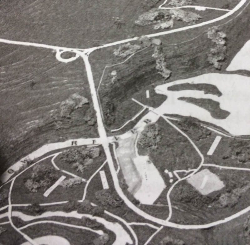
(Glenbow Archives NA-5600-8138a. Click for an enlargement of the Elbow River crossing)
The crossing, depicted as a 4-lane low-level bridge of about 180m in length with some amount of cut-and-fill on the north bank of the valley, was only conceptual at this stage. Detailed work on the entire development had yet to be carried out at the time of the model’s creation, and no engineering had gone into the designs at this point. (The road is shown along the bottom of the photograph above). Continue reading “Crossing the Elbow River – 1956 to 1986”