A Brief History of 37 Street SW

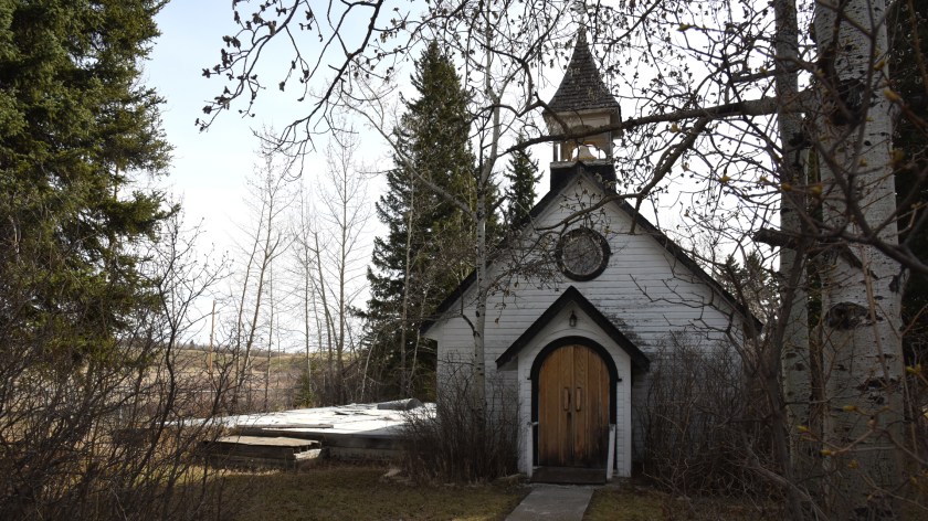
What follows is a short historical overview of the history and use of 37 Street SW in the community of Lakeview in Calgary. The road has a surprisingly long and interesting history, with a long tradition of First Nations, Military and Community use of the corridor since it was first set aside as a road.

In 1883 the Tsuut’ina Nation reserve was first surveyed and reserved for the Nation, shown below.

1883-small

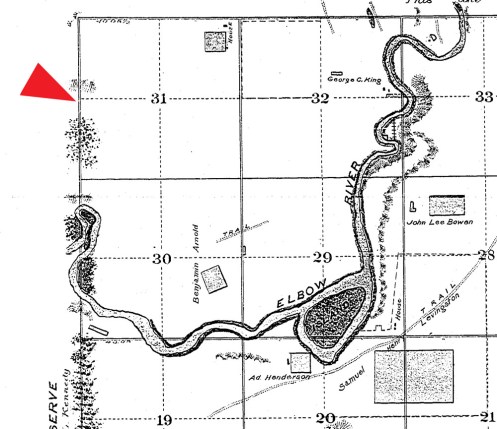
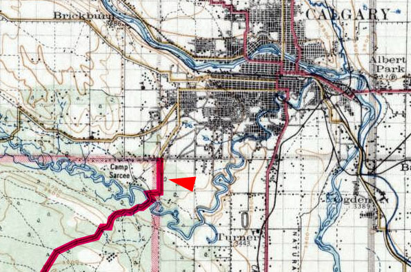
The same year the adjacent township was surveyed, dividing up what is now SW Calgary. This survey laid out the 66-foot-wide 37 Street SW road allowance for the first time. The arrow on the survey below indicates the road.

1883-survey-close

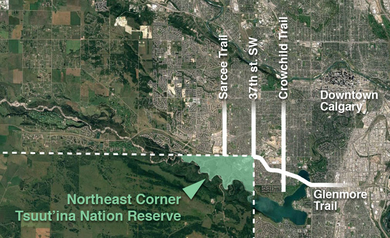
When the reserve was first created, the Tsuut’ina Nation established a trail through the reserve to access Calgary at what is now 37 Street SW and Glenmore Trail. This route was part of a trail known as the Priddis Trail. The map below from 1897 shows this trail.

1894_map_small

In 1900 the government formalized that trail into a highway through the reserve, and moved the reserve entrance to what is now the Weaselhead parking lot at 37 Street SW and 66 Avenue SW. Accessing the reserve meant traversing one mile of 37 Street. Below is a map from 1926 showing route of the Priddis Trail.

1926-PT-H22

For a brief time in 1930 the Priddis Trail, including that portion of 37 Street SW, was earmarked as the route of Highway 22, before ultimately being built from Midnapore.

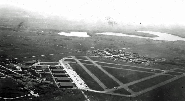
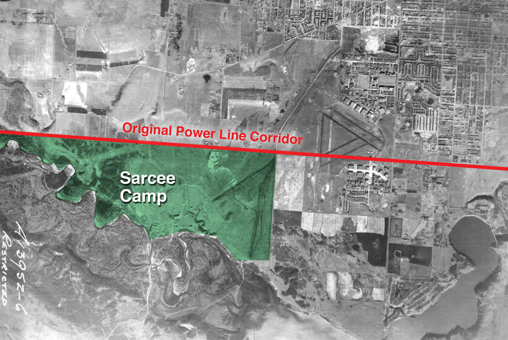
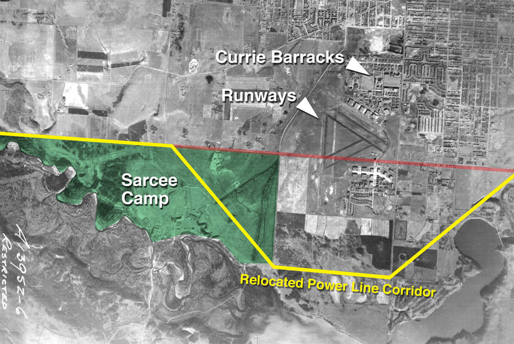
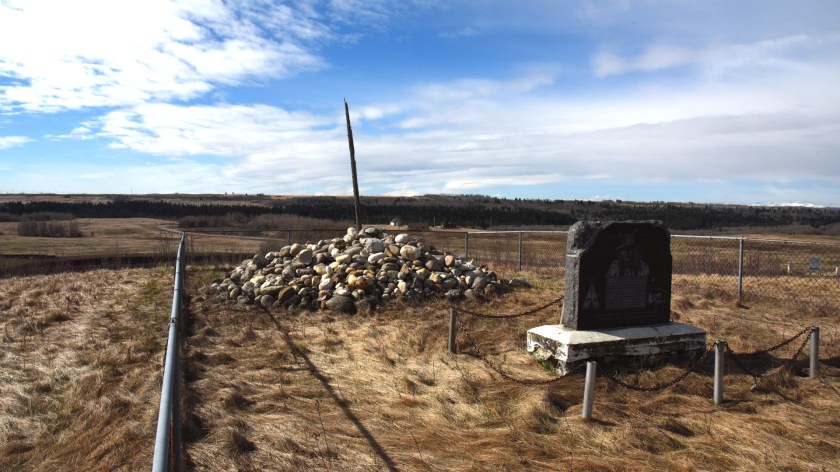
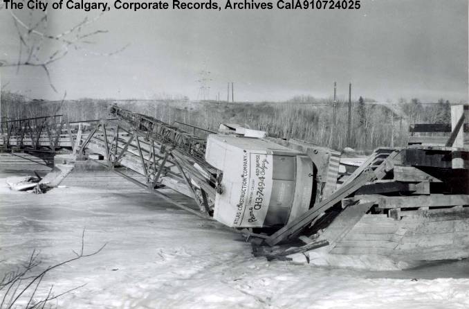
The Priddis Trail served the Nation and Calgarians for 58 years, until the bridge over the Elbow collapsed in 1958 (pictured below). Nation citizens had already been using the Military’s new bridge, which was constructed around 1950 over the Elbow river, and returned to using the old reserve entrance point at the intersection of Glenmore Trail and 37 Street SW.

weaselhead-bridge-damage-1959-2001-004-cala-910724025

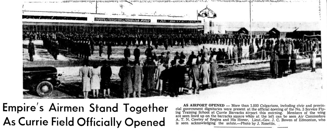
The Military built several more roads in 1957-58 that connected to 37 Street SW to allow access to Military housing and a school on the west side of the road. At this point in time, access to the Military base, the Tsuut’ina Nation reserve and a cattle ranch are the primary uses of 37 Street SW, and construction of Lakeview had not yet been started. The map shown below is from 1960.

1960-calgary.jpg

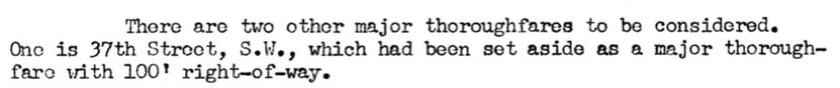
When planning for the new community of Lakeview began in 1959, the City of Calgary designated 37 Street SW as a ‘Major Thoroughfare’ and added 34 feet to the width of the road’s original corridor.

1959-major

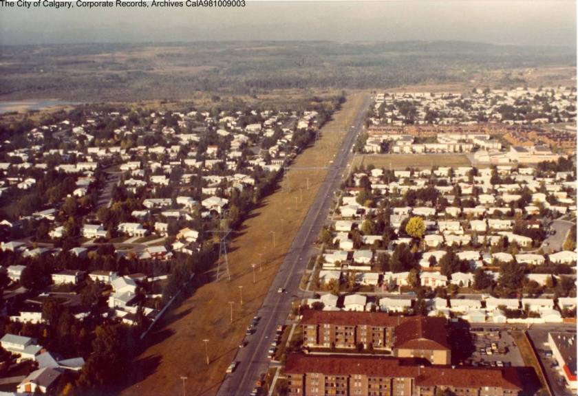
In 1960, construction began on the neighbourhood. The first houses were built on the east side of the community, near Crowchild Trail. Over the next decade construction moved west, closer to the newly-paved 37 Street SW, and the final phase of Lakeview’s original single-family homes were built in 1968-69. Below is a picture of Lakeview from the 1970s, looking west along 66th Avenue SW.

66th ave 1970ish

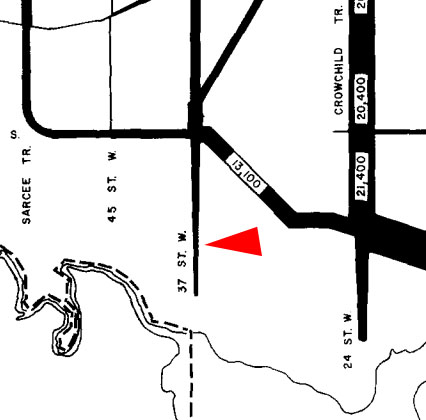
In 1970, after much of Lakeview is largely completed, traffic maps for the first time show traffic on 37 Street SW. About 5,000 cars per day are shown on the road near Glenmore Trail, with the numbers dwindling lower towards the south end of the road. The change of the road from rural right-of-way into suburban thoroughfare marks the most significant change in the use of 37 St SW in the history of the road. Traffic on 37 Street SW was at its peak in the 1970s, when Military use, Lakeview access, and users of North Glenmore Park constituted the majority of traffic. In the 1990s the Military base was closed, and traffic has declined overall since that time. The City of Calgary’s traffic map from 1970 is shown below.

1970-traffic

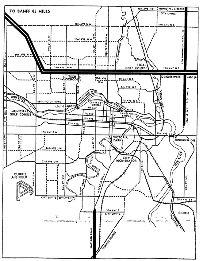
In 1967 the City of Calgary had already planned for the 37 Street SW – Glenmore trail interchange to be a ‘diamond’ style interchange when conditions warranted it. The plan from the City of Calgary’s 1967 CALTS report is shown below.

37-1967

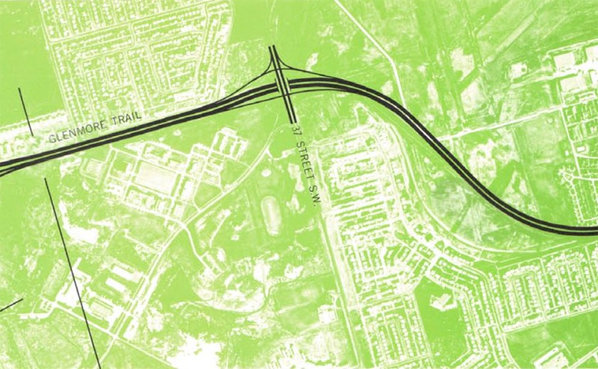
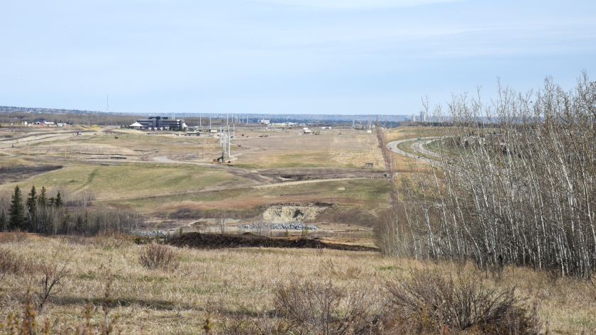
In 2010 a new temporary interchange was built at 37 Street SW and Glenmore Trail. The interchange was designed so that the bridge over Glenmore Trail was located away from where a permanent interchange would eventually be built. This would allow the interchange to remain open while a new interchange was being constructed. The current interchange is shown below, looking towards the Southwest.

37-2010

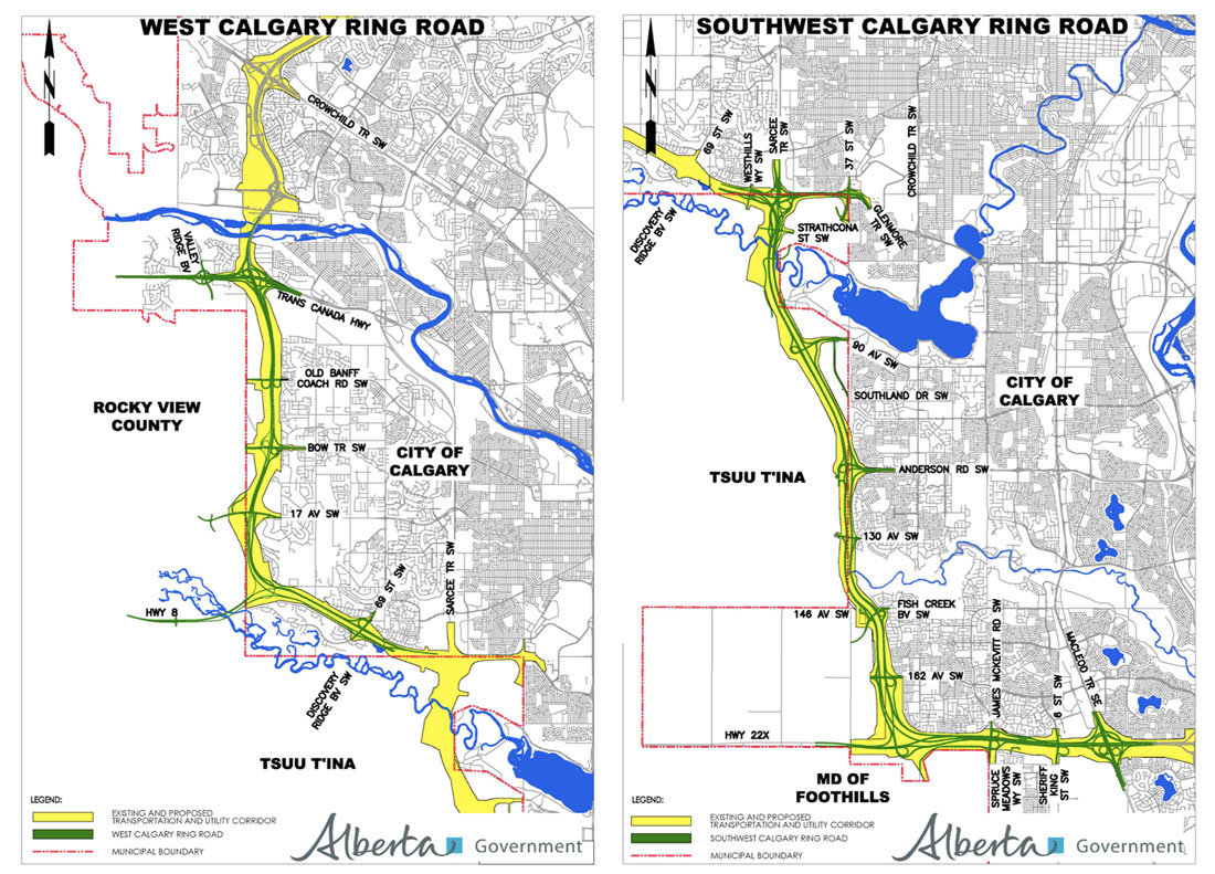
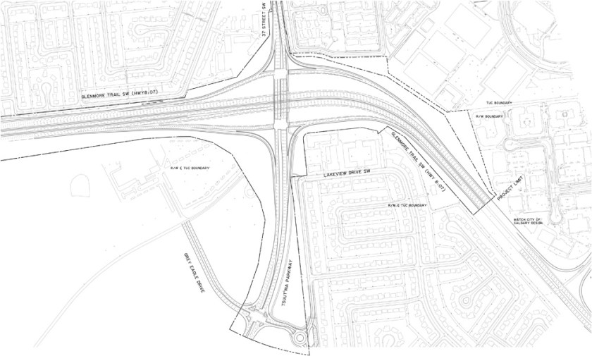
In 2013 the Province of Alberta and the Tsuut’ina Nation entered into an agreement to sell land for the Southwest Calgary Ring Road. This agreement guaranteed access to the Tsuut’ina Nation reserve at 37 Street SW and Glenmore Trail as part of the ring road project. If this access is not provided, the ownership of the entire ring road corridor through the reserve will revert back to the Nation. The design of the new permanent interchange is shown below.

37th-NEW

The contract for construction of the ring road project including the new interchange at 37 Street SW and Glenmore Trail was awarded in 2016, and some initial earthworks has already begun. The interchange is set to open by 2021.

Advertisement

Electric Transmission Line Relocation

Building the Southwest Calgary Ring Road project is a massive enterprise, and includes the construction of hundreds of kilometre-lanes of roads, 49 bridges and 14 interchanges, but the project involves more than just a freeway. One of the first projects to be undertaken in preparation for the construction of the ring road involves the relocation of an electrical transmission line; one that not only crosses the ring road corridor, but also bisects the Northeast corner of the Tsuut’ina Nation reserve.

NE-corner-small
A satellite image showing the location of the northeast corner of the Tsuut’ina Nation reserve in relation to southwest Calgary. Source: Google Earth.

AltaLink, the company that owns the bulk of Alberta’s electrical transmission network, is currently in the process of installing a new underground transmission line within the right-of-ways for Glenmore Trail and 37th street SW. This work is being done in advance of the decommissioning and salvage of the portion of the existing line that crosses the reserve, and the story of how the existing line ended up on reserve land, and why it is now being removed, is an interesting one that dates back almost 100 years.

The Start of the Line

In 1924 the Calgary Power Company Ltd. planned an electric transmission line to connect their hydroelectric operations at horseshoe falls on the Bow river to south Calgary. Transmission Line No. 3 was to split off from an existing line at Jumping Pound, then head south and east for 35 kilometres to Macleod Trail at 50th avenue SW.1 Despite a few alterations over the years, this route remains largely intact and in service today.

Calgary-satelitte-jumpingpound2-wide-small
Map showing the full extend of Transmission Line No. 3, from Jumping Pound to the intersection of 50th Avenue SW and Macleod Trail. Source: Google Earth, ‘Plan showing land required for right-of-way of Transmission Line No. 3 from Jumping Pound to Calgary through Townships 23 & 24 in Ranges 1, 2, 3 & 4 all west of the fifth meridian and through the Sarcee Indian Reserve’ R.V. Heathcott. Calgary Power Company Ltd. Alberta Land Registry Plan RW176. 1924.

The route for the new line was surveyed, and a corridor of between 30 and 100 feet in width was allocated to the utility, including a small section that ran through the Tsuut’ina Nation reserve (then known as the Sarcee reserve). A 3.7 km portion of the line was earmarked along the northern boundary of the Nation’s land, adjacent to what is now Glenmore Trail between about 69th street SW and 37th street SW. The 100-foot-wide corridor comprised 31.6 acres of reserve land, through an area known as Sarcee Camp or The 940.2

irr2059
Survey showing the route of Transmission Line No. 3 as it crosses the Tsuut’ina Nation reserve. Source: ‘Plan showing land required for right of way of Transmission Line No. 3 in the Sarcee Indian Reserve through Tp.23 Rg.2 W5th Mer.’ R.V. Heathcott. Calgary Power Company Ltd. Canada Lands Survey Plan IRR 2059. 1924.

At the time of the survey, this part of the Tsuut’ina reserve was under lease to the Department of National Defence. Known as Sarcee Camp, the land had been turned into a training camp in 1915 in the midst of the First World War. When permission to cross this land was sought by the Calgary Power Company, the request was handled by the department of Indian Affairs, and no record of the involvement or approval of the members of the Tsuut’ina Nation are on file with the Federal Government.

The Federal Indian Commissioner valued a corridor agreement at $1000, which the Calgary Power Company paid in order to secure a perpetual easement for the power lines.3 On December 8 1924, the Superintendent General of Indian Affairs and representatives of the Calgary Power Company ratified the agreement, with the Department of National Defence signing off on a clause that would not hold the Military liable for “damage or injury done to the… transmission line… which may result from the use of the said Sarcee Camp for Military training…” and which would also compensate the Military for any damage caused by the operation of the line.4

With the survey in place and permissions acquired from other landowners along the entire route, the line was soon under construction. In 1926 the line was energized, and began to serve the increasing electricity needs of a growing modern city.

War and (Electrical) Power

Throughout the late 1920s and 1930s Transmission Line No. 3 operated unobtrusively side-by-side with Sarcee Camp. The camp was in regular use for peace-time training, but the outbreak of another war would change much on the Tsuut’ina reserve, including the transmission line.

In 1939 Canada became embroiled in World War 2, and military installations across Canada, including Sarcee Camp and the newer Currie Barracks to the north, were seeing increased use.

p_calgary6
Photo of the runways at Currie Field, with the Glenmore reservoir in the background. Source: Richard Brown. Bomber Command Museum of Canada.

As part of the war effort, the Canadian Government earmarked Calgary as the site of a new air school. Service Flying Training School No. 3 was to be established on land directly northeast of Sarcee Camp as part of the British Commonwealth Air Training Plan,5 a scheme that would see tens of thousands of airmen trained across Canada and the world during the war. The land selected for the new air school had already seen use as an airfield for a number of years as Currie Airfield, but formal runways hadn’t been constructed up to that point.

Transmission Line No. 3 crossed directly through the chosen location for the new triangular runway of the flight school, and this overlap meant that the power lines had to move. A slight relocation of the line would not suffice as the raised power lines posed a threat to taking-off and landing aircraft,6 so a more significant move was required.

1955-step1
Aerial photo showing the location of Sarcee Camp, and of the Transmission Line No. 3 corridor that ran along the 50th avenue SW road allowance. Source: Photo A13952-6, University of Calgary Alberta Air Photo Collection. National Airphoto Library. 1955.

In June of 1940 the Acting Deputy Minister (Air Service) of the Department of National Defence asked for permission to move the transmission line further south into the reserve, bisecting the Sarcee Camp lands. Within a few days, the Deputy Minister of the Indian Affairs Branch replied with an approval of the idea, in part because the cost of the relocation would not be charged to the Nation, and also because “…this proposed diversion will not in any way interfere with the activities of the Sarcee Indians…”.7

There is no record of any approval of the relocation by Tsuut’ina Nation members, nor of the Nation being notified of the potential move. Since the Department’s approval was granted less than a week after receiving the request, there would have been insufficient time for a formal surrender to have been granted by the Nation. As this was a case of one Federal department communicating directly with another, it appears unlikely that the request ever left Ottawa.

1955-step2
Aerial photo showing the position of the relocated transmission line across Sarcee Camp, and the relative location of the Currie Barracks and the air school runways. Source: Photo A13952-6, University of Calgary Alberta Air Photo Collection. National Airphoto Library. 1955.

The same week that the Department granted permission for the transmission line move, the Tsuut’ina Nation’s Chief and Council made a related approval of their own. On June 19 1940, the Nation passed a Band Council Resolution approving the sale of gravel from the reserve to Dutton Brothers contractors, for use in constructing the new runways.8 Following a survey of the newly-altered power line corridor, the runways were under construction and nearly 5 km of the transmission line was shifted 1.6km south of its original corridor. The transmission line now diagonally crossed Sarcee Camp, and headed east through what would later become the community of Lakeview, only returning to its original route once it was clear of the airspace of the new air school.9

1940-rcaf
Article announcing the opening of the Service Flying Training School No. 3. Calgary Herald, October 28 1940.

On the morning of October 28 1940, only 132 days after receiving permission to move the transmission lines, the flight school was officially opened. With the airspace clear and the runways built, the air school was ready to begin training new pilots and airmen. Continue reading “Electric Transmission Line Relocation”

A day on the Tsuut’ina Nation reserve

On May 3rd, 2017, I was fortunate enough to accompany Hal Eagletail on a tour of the Tsuut’ina Nation reserve. Hal is a well respected cultural leader of the Tsuut’ina, and the Lakeview Community Association’s Tsuut’ina Nation Relations Committee had invited him to speak to residents about the history and culture of the Nation. Hal wanted to show certain areas of the reserve in his presentation, and as chairman of the committee, I was asked if I was interested in seeing more of the land and to take photos. I was treated to an incredible day, listening to some of the stories and walking the land of the Tsuut’ina Nation.

Any mistakes in the stories recounted in this post are mine and not Hal’s. While the post below covers some of what was presented in Hal’s talk, I recommend watching the video of the presentation, which is shown at the end of this post.

DSC_0931 Da ni t'a da

‘Danit’ada’ is the traditional Tsuut’ina greeting.

DSC_0887 cairn other angle
Rock Cairn

On the signing of Treaty 7 in 1877, the Tsuut’ina Nation was allocated a reserve adjacent to the Siksika Nation, near what is now Bassano, Alberta. After negotiating with the Federal Government for their own land, the area around Fish Creek (known as Wolf Creek to the Tsuut’ina) was selected by Tsuut’ina scouts. The scouts created a pile of rocks on a hill overlooking the creek in order to mark the land, and in 1883 when the new reserve was established, Chief Bullhead placed a rock on the pile and told all of his people to place their own rock. To this day, every Nation member continues to place a rock on the pile when they come of age, and as the Nation grows, so to does the pile.

A marker stone telling the story of the cairn was unveiled by Prince Charles in 1977.

DSC_0888 museum
New Tsuut’ina Museum

Near the rock cairn is the new Tsuut’ina Nation museum. The previous museum was established in the early 1980s, and was located in the old Seven Chiefs sportsplex building. When the sportplex was torn down a few years ago to make way for the Southwest Calgary Ring Road, the museum’s collection was put into storage to await a new home. The new museum is located just south of Chief Bullhead’s old house (built in 1909) is slated to open on Treaty Day, June 28 2017.

DSC_0891 Agents house
Indian Agent’s House

For decades, Federal employees known as Indian Agents were sent to oversee nearly every aspect of a First Nation’s business. The agent would typically live on the reserve they were sent to manage, in a house provided by the Government. This hundred-year-old Agent’s house, with its three fireplaces, was considerably larger than any other residence on the Tsuut’ina Nation reserve including the Chief’s house.

DSC_0894 residential school
Residential School Site

The lone spruce tree just to the right of the centre of the photograph above grows on the site of the old Tsuut’ina Nation reserve residential school (the Anglican St. Barnabas School). In the foreground is a thicket of yellow lilac bushes planted by the children who lived at the school.

DSC_0901 church
Anglican Church

Pictured is the third Anglican Church built on the reserve. The foundations of the second church lie to the left of the church in this photograph. The first church, established in the late 1880s, was a sod building.

DSC_0904 SWRR closer 2
Southwest Calgary Ring Road Corridor

This view, looking north, shows the new Southwest Calgary Ring Road corridor along the eastern edge of the Tsuut’ina Nation reserve. The Wolf Creek/Fish Creek valley is in the foreground, and the fence-line to the right of centre of this photo denotes the previous boundary of the reserve, adjacent to 37th street SW and the community of Woodbine. The Nation’s Administration building is visible at the left of the photo.

Hal recounted that in the 1800s a man named Eaglerib had a vision: that the land chosen for the Tsuut’ina Nation reserve would one day be surrounded by boxes, and that these boxes would allow the Nation to prosper. Over a hundred years later, the houses of Calgarians will soon surround the reserve on three sides. With the new ring road being built to provide access to future commercial developments, the growth and proximity of the City of Calgary is seen to be fulfilling Eaglerib’s vision of a coming prosperity for the Nation. Continue reading “A day on the Tsuut’ina Nation reserve”

Jane’s Walk 2016 – Sunday May 8

Jane's Walk graphic photo 2016 small

THE HISTORY OF THE SW RING ROAD AND THE WEASELHEAD WALK

Why was the SW ring road planned through a First Nations reserve? How did the Weaselhead come to be owned by the City of Calgary? Why are Unexploded Ordnance being found in the Elbow river valley?

Join me again on this year’s Jane’s Walk through a beautiful and historic part of Calgary, and learn about the soon-to-be-built SW ring road, 60+ years in the making.

Weaselhead Janes Walk wide

The turn-out for last year’s walk was fantastic, and I will be leading it again this year. The walk will be a look at the history of the SW Ring Road, and will give anyone who is interested the chance to explore the past, present, and future of the Weaselhead; one of the most historically rich areas of Calgary.

Travel along the first Provincial highway that was built through the Tsuut’ina Nation reserve over 115 years ago (with origins dating back even before the signing of Treaty 7) and through land that was purchased in the 1930s for the Glenmore Reservoir. See where the Canadian Military operated the largest WWI training camp in Western Canada, and explore the legacy of disputed land ownership and unexploded ordnance that years of military use has left behind. Experience one of the quietest corners of the city adjacent to where the SW Ring Road is planned to be built, see where previous plans would have located the road over the valley, and look at the role that future economic development played getting the road approved. Continue reading “Jane’s Walk 2016 – Sunday May 8”

SW Ring Road Information Sessions Announced

Alberta Transportation has announced the dates and locations for their upcoming information sessions, covering the West and Southwest Calgary Ring Road projects.

W&SW_Ring_Road Continue reading “SW Ring Road Information Sessions Announced”

Casino Access and Bargaining Chips

In July of 2009, Calgary Mayor Dave Bronconnier stated “One thing is for sure. The legal access to the First Nation’s land is off of Anderson Road. And so we will have to accommodate and work with our neighbours as we always do… At the end of the day, we need to build an interchange at 37th Street SW and Glenmore (trail) and, most importantly, Calgarians just want us to get on with it.” Over the next few days, Bronconier indicated that while access to the reserve would always be maintained at Anderson Road, the access to the reserve and the Tsuu T’ina’s Grey Eagle Casino at Glenmore Trail and 37th street SW was only ‘considered temporary’. This was disputed by the Nation, and soon legal threats were issued over potential limits to reserve access.

37th_and_anderson_access

The concept of a single, legally required access point between the City of Calgary and the Tsuu T’ina reserve has been raised in recent years by politicians and the media. So too has the suggestion that the access road to the Grey Eagle Casino is only temporary in nature. However, is this really the case? Is the City only required to provide a single connection? Is the entrance to the reserve near the casino provided as a courtesy, or does that access exist as a right of the Nation? The issue around this access point is highly charged, politically sensitive, and like most aspects of this story, comes with a long history behind it. Continue reading “Casino Access and Bargaining Chips”

1977 Sarcee Trail South Route Location Study

Though the planning for a Southwest Ring Road had been started in the early-to-mid 1950s, it remained little more than a line on a map for the next few decades. It took the pressures of growth, and the establishment of a new Provincial park, for the City to move the project from long-range thinking to a more detailed phase of planning. By the mid 1970s the planning for the Sarcee Trail extension, as it was then known, had become a priority to the City, even if the need for the road was recognised to still be decades away.

1977_cover

The study would look at routes that traveled from Glenmore Trail to Highway 22x, though I will focus on the portion that crosses the Elbow River, from Glenmore Trail to Anderson Road. For more on the crossing of the Fish Creek, see here. Continue reading “1977 Sarcee Trail South Route Location Study”

Why plan a road through the Tsuut’ina reserve?

Modern plans have for decades shown the Southwest Calgary Ring Road as traveling through the northeast corner of the Tsuut’ina reserve. As these plans for the road had utilised land that cannot be guaranteed to be available, many have wondered why the City allowed communities like Lakeview and Glamorgan to grow right up to the city-limits, leaving no room for a ring road. With no corridor protected for this road, some have openly blamed the City for failing to plan ahead, but is this really the case?

Early Road Planning

Although there were early attempts at planning the major roadways in Calgary, notably Thomas Mawson’s plan of 1914 and the City’s 1930 Major Street & Arterial Highway plan, 1952 marked the first modern road plan for the city of which all subsequent plans are indebted. The 1952 plan (below) was the result of a push in 1948 for a masterplan for Calgary, not just for street layout but for all future growth for the city including land-use and zoning.

1952_major

The explosion of car ownership in the post-war era had compounded congestion in the downtown core of Calgary, and the need to design a road network that would accomodate new traffic and allow drivers to avoid downtown was seen as paramount in allowing for the continuing growth of the city. Although the Major Thoroughfare Plan shows improved bypass roadways that avoid the core of the city, the proposed road network was contained within the city-limits of the time, and no regional bypass routes or ring roads feature in the plan. That state of affairs was soon to change, and beginning the following year, the City began the process of planning a ring road system for Calgary. Continue reading “Why plan a road through the Tsuut’ina reserve?”

The Priddis Trail and the Weaselhead Bridge

A growing population south of Fish Creek are demanding a road through the Tsuu T’ina reserve to be able to get to central Calgary easier. The Government has approached the Nation about routing a road through the reservation and crossing the Elbow River at the Weaselhead. If this sounds familiar, the next part probably will not: The Tsuu T’ina agree to the road, the land is surrendered at no cost, and the road is built. The year is 1900, and a road through the Weaselhead and the reserve is open to the public.

(Photo by Alison Jackson of the Priddis Trail near what is now the Weaselhead parking lot, September 29 1963. Courtesy of the Calgary Public Library, Community Heritage and Family History Digital Library.)

Continue reading “The Priddis Trail and the Weaselhead Bridge”

Tunneling the Weaselhead

If you can’t go around it, and you don’t want to go through or over it, what’s left? Going under it.

The tunneling of the Weaselhead was alluded by the Province of Alberta in 2011. Their  ‘Plan B’ for a southwest Calgary ring road alternative route that did not require land from the Tsuu T’ina identified several non-traditional concepts for road building, including tunneled and elevated highway construction. However, the idea of a tunnel in the Weaselhead area is not new; it was first mentioned publicly almost 40 years ago. But while tunneling may technically be an option, is it realistic?


Continue reading “Tunneling the Weaselhead”