The Rise and Fall of the Priddis Trail – Part 3: Closure

This is the third in a five-part series looking at the history of the Priddis Trail. The first part, which examined the establishment of the road can be found here. while part two, focusing on the early years of the road is here. I acknowledge that the resources that inform this work are largely that of non-First Nations sources, and in particular this article will focus on a non-indigenous perspective on the decline of the Priddis Trail. The next article will look more at the Military’s use of the Priddis Trail, while the final part looks at the problematic legacy of this road, and will begin to address the perspective not covered in this section.


Three decades after beginning life as a Government highway, the Priddis Trail was in 1930 a well-used main road that served a growing agricultural district, a burgeoning oil industry, a First Nation and an important Military training camp.

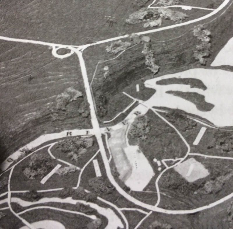
The establishment in 1900 of the road, built along the route of an old trail that crossed the Tsuut’ina Nation reserve, was originally done in order to provide reliable access to lands located southwest of Calgary. The original trail between the city and the Priddis area was notorious for its chronically poor, often impassable condition, and it was expected that upon acquiring the corridor for the road from the Tsuut’ina Nation, the Government would create and maintain a modern and reliable road. It was this desire for better access that led homesteaders to petition the government to acquire the road in the first place, and yet three decades later, this objective remained largely unfulfilled; although a road had certainly been built, it was proving far from suitable.

1926-pt(The route of the Priddis Trail (magenta) between Calgary and Millarville through the Tsuut’ina Reserve (outlined in light-pink). Source: Topographical Survey of Canada, Department of the Interior. Calgary District, Alberta. Ottawa: Department of the Interior, 1926. Peel’s Prairie Provinces Archives, University of Alberta. Map 17. Highlight added.)

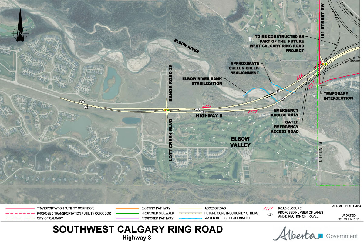
The new road suffered from the same wet, periodically impassible conditions that plagued the original wagon trail. The condition of the road was exacerbated in the 1920s` by an influx of traffic brought on by an oil boom in the Turner Valley, which the Priddis Trail increasingly served. In 1930 the Province of Alberta recognized that improving the road with proper drainage and a gravelled surface would benefit both residents and industry alike, and secured funding to improve and reconstruct the road in order to make the Priddis Trail into what would soon be known as Highway 22. Continue reading “The Rise and Fall of the Priddis Trail – Part 3: Closure”

2015 Southwest Calgary Ring Road Maps

The following maps were released to the public in October of 2015 by the Province of Alberta, and rather than relying on older or historical maps of the project, I wanted to ensure that the most up-to-date information was available to readers. These are likely to remain the most current views of the road until a contractor is selected in September of this year.

Please click on the maps for larger versions.

Southwest Calgary Ring Road Route

From North to South, the following maps show the full route of the Southwest Calgary Ring Road project as it currently stands:

1) While not part of the Southwest Calgary Ring Road, Highway 8 from Lott Creek Boulevard to the Calgary City Limits at 101st Street SW will be twinned as part of the project, including a new bridge over the Elbow river.

01-SW-CRR-Highway_8


2) The Southwest Ring Road begins at the Highway 8 Corridor, from Calgary City Limits at 101st Street SW, to the interchange at 69th Street SW.

02-SW-CRR-69th_Street_SW


3) Interchange of Glenmore Trail SW and Sarcee Trail SW, including Glenmore Trail upgrades between Sarcee Trail SW and the 37th Street SW interchange. Also shown are the interchanges with Westhills Way SW and Strathcona Street.

SW-CRR - Sarcee Tr SW / Glenmore Tr SW / 37 Street SW / Westhill Continue reading “2015 Southwest Calgary Ring Road Maps”

The Rise and Fall of the Priddis Trail – Part 1: Establishment

Though the Southwest Calgary Ring Road is perhaps the best known Provincial road to be planned through the Tsuut’ina Nation reserve, it is not the first; over a hundred years ago another Provincial road was sought, and built, across the Nation’s land. The story of the Priddis Trail, as the early road was known, may provide some much-needed context with which to view the long negotiations for the ring road project, and perhaps to understand how the legacy of previous land agreements may have influenced the current process.

priddis-trail-2015(Photo of a remnant portion of the Priddis Trail, 2015. Source: Author’s own.)

In this five-part series, I will look at the establishment of the old road through the Tsuut’ina reserve, the use and decline of the route as a public highway, and the problems surrounding the ownership and the handling of the land and the deal. Part two can be found here while Part three can be found here. I acknowledge that the resources that inform this work are largely that of non-First Nations sources, and while this is intended to be a factual look at the history of the road, it must be noted that the perspective is largely non-indigenous. I hope that further research, working with Tsuut’ina sources, will reveal other equally valid perspectives on this story in the future.

THE NEED FOR GOOD ROADS

At the turn of the century, settlers of the Priddis and Millarville areas of southern Alberta relied on well established, though informal and unmaintained, wagon trails in order to access Calgary and other areas and ranches of the region.

Calgary_priddis_reserve_area_new(Map of the Calgary area, showing the Tsuut’ina reserve and the Priddis area. Source: Google Maps.)

The provision of useful roads in the North West Territories was a constant battle for the Government, and many districts in the Territories, including Alberta, chronically suffered from poor or impassable routes. In 1900, the Department of Public Works noted this problem in its annual report:

“…so long as we have earth roads we must expect bad roads during wet seasons, and as the conditions in the Territories will not permit the construction of any other kinds of roads for many years to come it must be understood now that during certain years good roads will be an impossibility.” 1

In the midst of 1899, a notably wet year, local settlers and homesteaders called upon the Government of the North West Territories to improve and maintain a reliable road to the Priddis area. There already existed a well-used old trail between Priddis and Calgary, known locally as the Priddis Trail, or Gunawaspa Tina in Tsuut’ina, and it was this route that the locals wanted improved.2 Much like the case of the Southwest Calgary Ring Road, it was an alignment through the Tsuut’ina reserve that was seen by the Government as providing the most efficient route to serve those living south of central Calgary. In this case however, its use was reported to have predated the establishment of the reserve.3

PriddisTrail_1897(A map from 1897 showing the route of the Priddis Trail. Source: “Preliminary map of a portion of the District of Alberta showing Canadian irrigation surveys during 1894″. University of Alberta Libraries, Peel Map 747.)

Crossing the eastern portion of the Tsuut’ina reserve (at that time known as the Sarcee reserve) and leading diagonally from what is now the corner of Glenmore Trail and 37th street SW to a point just north of Priddis, the trail had been in use for many years by early European settlers of the area and Nation members. Like many in the North West Territories, the earthen trail suffered from regular periods of muddy and impassable conditions, and despite warnings that roads may not be improvable in the short-term, the Government had recently begun to prioritize important ‘Colonisation Roads’4 which connected newly settled areas and local market centres. Calls for the trail to be opened and improved as a public highway were heeded.

Continue reading “The Rise and Fall of the Priddis Trail – Part 1: Establishment”

Federal Funding Announcement

On Thursday July 30 2015, Federal Minister for National Defence and Multiculturalism Jason Kenney, along with Alberta Minister for Transportation Brian Mason, announced Federal funding for the Southwest Calgary Ring Road project.

At the announcement, also attended by Tsuut’ina Chief Roy Whitney-Onespot, Kenney detailed a commitment of $582.9 million, which represents one quarter of the estimated $2.8 billion cost for construction of this leg of the road. The funds are being earmarked from the National Infrastructure Component of the New Building Canada Fund, which ‘provides funding for projects of national significance’1.

July_2015_update_new

(Map showing the newly revised route of the Southwest ring road; from Macleod trail in the south, to west of 101st street SW in the west.)

Continue reading “Federal Funding Announcement”

Treaty Day

Yesterday, June 26 2015, the Tsuut’ina Nation celebrated Treaty Day, a day of celebrations capped off with a firework finale at the Grey Eagle Entertainment Centre. The day marks the establishment of the Tsuut’ina reserve with the signing of a Treaty 132 years ago.

treaty_1883

(Articles of Surrender and Treaty – the Sarcee’s of Treaty 7 to Her Majesty – IT 332. Docket Title Page portion. 1883. Library and Archives Canada)

Treaties and Reserves

The Tsuut’ina Nation first entered into a Treaty with the British Crown in 1877 with the signing of Treaty 7 in September of that year. This Treaty initially created a reserve at Blackfoot Crossing, near Gleichen Alberta, that was to be jointly shared between the Tsuut’ina, the Siksika and the Kainai Nations1. Following the disappearance of the Buffalo from the Alberta plains in the following years, and unrest with the shared reserve, the Nation moved near Fort Calgary in 1880. The Nation endured further hardships in the years follwing the signing of Treaty 7, and in the summer of 1881 discussions began with representatives of the Canadian Government for the creation of a new and separate reserve. After scouting potential locations, the Tsuut’ina settled along the Fish Creek that fall, on land that would soon be formally granted as a reserve.2

On June 27 1883, a new Treaty, as a supplement to Treaty 7, was agreed to by Chief Bull Head, Many Horses, Eagle Robe, Big Plume and Painted Otter. The new Treaty established the Tsuut’ina Nation reserve that we know today, having been surveyed the year before, and consisting of 108 square miles of land between Calgary and Bragg Creek.3

1889-sarcee

(Tsuut’ina reserve, surveyed 1882. Descriptions and Plans of Certain Indian Reserves in the Province of Manitoba and the North-West Territories, 1889. Nelson.)

Despite several surrenders and land sales over the years, the reserve borders have remained largely the same as was first granted in 1883. The only addition of land (above the initial allocation) happened this year, as a result of the Southwest Ring Road land swap; the additional lands that were added to the reserve in May of 2015 marked the first net-increase to the reserve since its establishment.

—–

For an oral account of the events leading up to the establishment of the Tsuu T’ina reserve in 1883, you can view the excellent discussion with Tsuu T’ina elder Hal Eagletail: https://vimeo.com/40184903 (beginning at 11:52). Also see the article “The ‘Sarcee War’: Fragmented Citizenship and the City” by Patricia K. Wood.

—–

Sources

1) Treaty No. 7 (Copy of Treaty and Supplementary Treaty No. 7 between Her Majesty the Queen and the Blackfeet and Other Indian Tribes, at the Blackfoot Crossing of Bow River and Fort Macleod). 1877. Retrieved June 27 2015 http://www.aadnc-aandc.gc.ca/eng/1100100028793/1100100028803

2) The ‘Sarcee War’: Fragmented Citizenship and the City. Patricia K. Wood. 2006.

3) Articles of Surrender and Treaty – the Sarcee’s of Treaty 7 to Her Majesty. 1883. Library and Archives Canada – IT 332

SW Ring Road Land Transfer Approved

On May 1 2015 the Privy Council of Canada passed order 2015-0556, which authorizes the transfer of the proposed Southwest Ring Road corridor to the Province of Alberta. The same day, the Council passed a separate order, 2015-0557, which adds and incorporates former Alberta Crown lands into the Tsuut’ina reserve. With these two documents the land acquisition required for the Southwest Calgary Ring Road is approved.

The Province transferred $275,000,000 to the federal government in April of this year. The payment for the land will only be forwarded to the Tsuut’ina Nation, and the land title will only be assigned to the Province, once the Federal Minister of Aboriginal Affairs and Northern Development Canada signs off on the transfer.

reserve_overall_1
(Source: Canada Lands Survey Records (CLSR) 103661 January 21, 2015 and CLSR 103574-1 December 17, 2014. Image: Google Maps)

The Image above shows the new boundaries of the Tsuut’ina reserve. The original reserve (created in 1883) is shown in blue, while the newly added land (2015) is shown in magenta. The Weaselhead (1931), the Highway 22 corridor (1957) and the Southwest Ring Road corridor (2015) have been removed from the original reserve.

Moving Forward

The 2013 referendum of Tsuut’ina members, and the subsequent ratification of the agreement, meant that the Nation approved the sale and exchange of lands in order for the Province to acquire the corridor needed to build the Southwest Calgary Ring Road. Over the past 18 months, both the Province and the Nation have worked to fulfill their obligations under the agreement, in order to ensure that the land transfers would be approved by the Federal Government. Once the transfer has been enacted, which provincial representatives expect soon, the Province will have seven years in which to construct the road.

The commitment to construct the road was recently reaffirmed by former Premier Jim Prentice in the Progressive Conservative’s 2015 Provincial Budget, with construction of this leg of the ring road planned to begin as early as 2016. Though a new government is now in place, a finalized transfer of the corridor will oblige the Province to construct the road as agreed, or face the loss of the land and the money already paid.

Premier-designate Rachel Notley did not take a definitive stance on the Calgary Ring Road in the course of the 2015 election campaign, though she is quoted in relation to the ring road project as saying “In principle we are adopting the capital funding envelope and the vast majority of the commitments that the [Progressive] Conservatives have already adopted so you’d see us being in line with what’s already in the budget.” (Calgary Herald, April 29 2015, ‘Wildrose Leader Brian Jean promises to finish Calgary ring road by 2021′)

Continue reading “SW Ring Road Land Transfer Approved”

Budget 2015 and the Ring Road

Yesterday the Alberta government announced details of the proposed budget for 2015, which includes information about the two remaining portions of the Calgary Ring Road. As a cost-cutting measure, the West Calgary Ring Road is being delayed by four years, and construction is now slated to begin in 2020/2021. Expected completion of this leg, and ultimately the entire ring road, will not occur until 2024/2025, and the measure is expected to defer a reported $1.5 billion from the current budget time-frame. W&SW_Ring_Road The Southwest Calgary Ring Road, the portion that runs through the Tsuut’ina Nation reserve, remains unaffected. Work will begin on this leg of the road once the Tsuut’ina land transfer has been approved and once a contract has been tendered and awarded, with construction expected to begin next year. The agreement signed between the Nation and the Province in 2013 commits the Province to open the Southwest portion of the road within 7 years of the land transfer, and the opening is estimated to occur in 2020. The 2015 budget allocates $2.9 billion over the next 5 years towards the construction of Alberta’s ring roads. This figure includes funds needed to complete Edmonton’s Anthony Henday Drive as well as beginning work on the Southwest Calgary Ring Road (interestingly referred to as ‘Southwest Stoney Trail’ in the Province’s 5-year Capital Plan despite a promised name change as the road crosses through former Tsuut’ina reserve lands).

Jane’s Walk – The SW Ring Road and the Weaselhead

Join me on a ‘Jane’s Walk‘ through a beautiful and historic part of Calgary, and learn about the soon-to-be-built SW ring road, 60+ years in the making.

Weaselhead Janes Walk wide

Why was the SW ring road planned through a First Nations reserve? How did the Weaselhead come to be owned by the City of Calgary? Why are Unexploded Ordnance being found in the Elbow river valley?

I will be leading a walk that will look at the history of the SW Ring Road, and give anyone who is interested the chance to explore the past, present, and future of the Weaselhead; one of the most historically rich areas of Calgary.

Travel along the first Provincial highway that was built through the Tsuut’ina Nation reserve over 100 years ago (with origins dating back even before the signing of Treaty 7) and through land that was purchased in the 1930s for the Glenmore Reservoir. See where the Canadian Military operated the largest WWI training camp in Western Canada, and explore the legacy of disputed land ownership and unexploded ordnance that years of military use has left behind. Experience one of the quietest corners of the city to see where the SW Ring Road is planned to be built, see where previous plans would have located the road, and look at the role that future economic development played getting the road approved.

Details

Date: May 3, 2015
Time: 1:00 pm
Duration: about 2 hours
Meeting Place: Weaselhead Parking Lot (West side of the corner of 37th street SW and 66th avenue SW in Lakeview)

Jane’s Walk in Calgary

Click here to visit the Jane’s Walk description for this walk
and
Cllick here to see all of the Jane’s Walks that will be happening this year (more will be added over the coming weeks)

Jane's-Walk-graphic-photo

UPDATE

I wanted to thank everyone who came to my ‘History of the SW Ring Road and the Weaselhead’ Jane’s Walk. More than 75 people came out to journey through a beautiful corner of Calgary, and were hopefully informed and entertained along the way.

I will be doing the walk again next year, so please look out for it next May!

IMG_2262 IMG_2249 IMG_2243 IMG_2237 IMG_2225

Crossing the Elbow River – 1990 to 1995

This article is the second in a series looking at the history of the crossing of the Elbow river near the Weaselhead. Part 1: 1956 to 1986 can be found here, and parts 3 and 4 will follow.


In the 1970s and 1980s, planning for the Southwest Calgary Ring Road, also known as the Sarcee Trail south extension, was characterized by practical considerations such as route location, land acquisition and functional planning. The period of the 1990s by contrast would be marked by something of a step-back from applied planning, and would include a serious re-examining of priorities.

The continued dominance of the automobile and the crossing of Calgary’s rivers by a network of freeways has often been seen as inevitable. This view, however, would be challenged by a renewed expression of concern over the impacts this situation would have on parks, communities and natural areas.

A New Transportation Bylaw for Calgary

In May of 1990 the City of Calgary released a preliminary look at a proposed bylaw that sought to affirm the city’s future transportation needs. In addition to public transit, bylaw 29M90 also detailed Calgary’s existing road network and plans for future expressways and freeways throughout the city. The plan was composed largely of elements from previous planning efforts, and included a map that showed proposed roads that had long been a part of City plans, including some that dated back to the early 1950s. The bylaw also contained a number of previously proposed, but as-yet unbuilt river crossings, including the southern extension of Sarcee Trail across the Elbow river. It is these crossings that would spark Calgary’s largest public consultation efforts undertaken to that point[1].

1990_crossings

(Source: Calgary bylaw 29M90. City of Calgary, 1990)

The bylaw included the following new river crossings (also shown above):
1. Stoney Trail NW over the Bow river
2. Sarcee Trail north extension over the Bow river
3. Shaganappi Trail south extension over the Bow river
4. South Downtown Bypass over the Elbow river
5. 50th Avenue South over the Elbow river
6. Sarcee Trail south extension over the Elbow river

Public reaction to the proposed bylaw was swift and largely unfavourable, with citizen groups particularly denouncing the negative impact that new river crossings would have on parkland, river valleys, natural areas and local communities[2]. Within a month of the bylaw’s unveiling, several hundred citizens had attended a City Council meeting on the topic, and many more contacted Aldermen, signed petitions and formed action groups to oppose the plan and to call for the process to be opened up to public consultation.

Although the bylaw was approved by Council in July 1990, the response from the public spurred the City to begin a multi-year, multi-million dollar consultation and review of the road network and future transportation needs the very next year. This process was called the GoPlan.

goplan

Continue reading “Crossing the Elbow River – 1990 to 1995”

Crossing the Elbow River – 1956 to 1986

The release of a ‘virtual tour’ video of the Southwest Calgary Ring Road this past week has given the public a chance to view the proposed plans for this road in a way that maps have not been able to. The detail and context provided by the video has raised concerns over the impacts the road will have on southwest Calgary, including the Elbow River, Fish Creek and the Weaselhead. The nature, size and proximity of the cut-and-fill river crossing, combined with a realignment of the rivers, appear to be at the heart of these concerns.

2014_elbow

(Source: Alberta Transportation)

The crossing of the Elbow river is arguably the most important link in the Southwest Calgary Ring Road project. This new crossing of the Elbow river in southwest Calgary, the first since the Glenmore causeway opened in 1963, is projected as being the single most utilized portion of the new road. Establishing this crossing has seen numerous proposals over the years; from a low-level bridge in the 1950s to a dam in the 1980s (creating a new reservoir upstream from the Weaselhead) to a consideration of a high-level bridge, and even talk of a tunnel, in the 2000s. A new crossing of the Elbow river is an idea that has undergone many revisions and alternatives in the decades since it was first proposed.

The first part of this story looks at the early proposals and the history of the crossing of the Elbow River, from the first proposal in 1956 to the project’s (temporary) cancellation in 1986. Part two, which looks at the modern river crossing plans and alternatives from 2000 to 2014, will follow.

Early plans: models and maps

In 1955 the Province of Alberta made public its desire to establish a bypass highway in Calgary’s southwest, and by the following year, the City had drafted initial plans for this road. Around the same time the City was also developing plans for the Glenmore Reservoir parks, and these two proposals would converge in the form of the first publicly released concept for the Southwest Ring Road, then known as the West Bypass, and its crossing of the Elbow river.

The ambitious plan for the proposed Glenmore Parks, containing an aquarium, a solarium, botanical gardens, an ‘Indian Village’ and more, was estimated to cost $3 million and would take upwards of 25 years to implement. When the City’s planning department was seeking approval from both the public and the City Council for the proposed park system surrounding the Glenmore Reservoir, they created a model of their proposed ideas. Along the western portion of the model lay the West Bypass, and its crossing of the Elbow river was presented to the public for the first time.

na-5600-8138a

(Glenbow Archives NA-5600-8138a. Click for an enlargement of the Elbow River crossing)

The crossing, depicted as a 4-lane low-level bridge of about 180m in length with some amount of cut-and-fill on the north bank of the valley, was only conceptual at this stage. Detailed work on the entire development had yet to be carried out at the time of the model’s creation, and no engineering had gone into the designs at this point. (The road is shown along the bottom of the photograph above). Continue reading “Crossing the Elbow River – 1956 to 1986”