Treaty Day

Yesterday, June 26 2015, the Tsuut’ina Nation celebrated Treaty Day, a day of celebrations capped off with a firework finale at the Grey Eagle Entertainment Centre. The day marks the establishment of the Tsuut’ina reserve with the signing of a Treaty 132 years ago.

treaty_1883

(Articles of Surrender and Treaty – the Sarcee’s of Treaty 7 to Her Majesty – IT 332. Docket Title Page portion. 1883. Library and Archives Canada)

Treaties and Reserves

The Tsuut’ina Nation first entered into a Treaty with the British Crown in 1877 with the signing of Treaty 7 in September of that year. This Treaty initially created a reserve at Blackfoot Crossing, near Gleichen Alberta, that was to be jointly shared between the Tsuut’ina, the Siksika and the Kainai Nations1. Following the disappearance of the Buffalo from the Alberta plains in the following years, and unrest with the shared reserve, the Nation moved near Fort Calgary in 1880. The Nation endured further hardships in the years follwing the signing of Treaty 7, and in the summer of 1881 discussions began with representatives of the Canadian Government for the creation of a new and separate reserve. After scouting potential locations, the Tsuut’ina settled along the Fish Creek that fall, on land that would soon be formally granted as a reserve.2

On June 27 1883, a new Treaty, as a supplement to Treaty 7, was agreed to by Chief Bull Head, Many Horses, Eagle Robe, Big Plume and Painted Otter. The new Treaty established the Tsuut’ina Nation reserve that we know today, having been surveyed the year before, and consisting of 108 square miles of land between Calgary and Bragg Creek.3

1889-sarcee

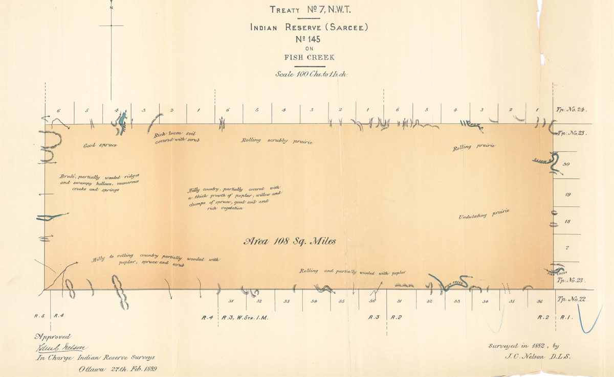
(Tsuut’ina reserve, surveyed 1882. Descriptions and Plans of Certain Indian Reserves in the Province of Manitoba and the North-West Territories, 1889. Nelson.)

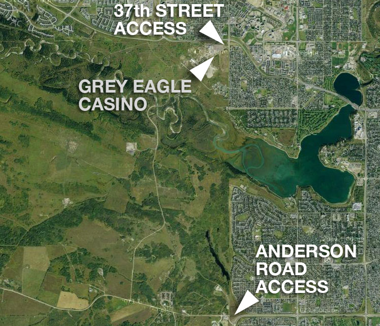
Despite several surrenders and land sales over the years, the reserve borders have remained largely the same as was first granted in 1883. The only addition of land (above the initial allocation) happened this year, as a result of the Southwest Ring Road land swap; the additional lands that were added to the reserve in May of 2015 marked the first net-increase to the reserve since its establishment.

—–

For an oral account of the events leading up to the establishment of the Tsuu T’ina reserve in 1883, you can view the excellent discussion with Tsuu T’ina elder Hal Eagletail: https://vimeo.com/40184903 (beginning at 11:52). Also see the article “The ‘Sarcee War’: Fragmented Citizenship and the City” by Patricia K. Wood.

—–

Sources

1) Treaty No. 7 (Copy of Treaty and Supplementary Treaty No. 7 between Her Majesty the Queen and the Blackfeet and Other Indian Tribes, at the Blackfoot Crossing of Bow River and Fort Macleod). 1877. Retrieved June 27 2015 http://www.aadnc-aandc.gc.ca/eng/1100100028793/1100100028803

2) The ‘Sarcee War’: Fragmented Citizenship and the City. Patricia K. Wood. 2006.

3) Articles of Surrender and Treaty – the Sarcee’s of Treaty 7 to Her Majesty. 1883. Library and Archives Canada – IT 332

Advertisement

Storm Trunk Relocation: The first steps to the SW Ring Road

In June of 2015, the City of Calgary will begin to construct some of the first tangible work on the Southwest Calgary Ring Road Project. This work will not be on the road itself, but will be related to utilities that will run under part of the project.

The City and Province of Alberta has agreed to construct a new storm sewer line to replace the existing South Richmond Storm Trunk that currently crosses a portion of the Tsuut’ina Nation reserve known as ‘the 940‘. The new line will be located entirely within the City of Calgary city limits along 37th street SW in Lakeview when completed, while the old line will be abandoned. This abandonment and replacement is not due to the functionality or suitability of the existing infrastructure, rather it is necessary due to reasons that are political and jurisdictional in nature; reasons that go back more than 60 years.

stormtrunk_b

Continue reading “Storm Trunk Relocation: The first steps to the SW Ring Road”

Casino Access and Bargaining Chips

In July of 2009, Calgary Mayor Dave Bronconnier stated “One thing is for sure. The legal access to the First Nation’s land is off of Anderson Road. And so we will have to accommodate and work with our neighbours as we always do… At the end of the day, we need to build an interchange at 37th Street SW and Glenmore (trail) and, most importantly, Calgarians just want us to get on with it.” Over the next few days, Bronconier indicated that while access to the reserve would always be maintained at Anderson Road, the access to the reserve and the Tsuu T’ina’s Grey Eagle Casino at Glenmore Trail and 37th street SW was only ‘considered temporary’. This was disputed by the Nation, and soon legal threats were issued over potential limits to reserve access.

37th_and_anderson_access

The concept of a single, legally required access point between the City of Calgary and the Tsuu T’ina reserve has been raised in recent years by politicians and the media. So too has the suggestion that the access road to the Grey Eagle Casino is only temporary in nature. However, is this really the case? Is the City only required to provide a single connection? Is the entrance to the reserve near the casino provided as a courtesy, or does that access exist as a right of the Nation? The issue around this access point is highly charged, politically sensitive, and like most aspects of this story, comes with a long history behind it. Continue reading “Casino Access and Bargaining Chips”

Unexploded Ordnance in Southwest Calgary

The 2013 southern Alberta floods did more to Calgary than damage houses and severely interrupt lives; the floods unearthed and highlighted a problem that has caused concern, and worse, for decades. In July, two unexploded military shells were found on the shores of the Elbow river in the Weaselhead area, exposing a legacy of unexploded ordnances (UXO) that lie just beneath the surface of a portion of southwest Calgary, including the potential route of the southwest ring road.

weaselhead_uxo

(Image of shell found in the Weaselhead area, July 2 2013. Courtesy Mark Langenbacher) Continue reading “Unexploded Ordnance in Southwest Calgary”

Water, Sewer and Roads

The issue of extending utility services from the City of Calgary to the Tsuu T’ina reserve has long been a key yet subtle part of ring road negotiations. While on paper these issues have rarely been explicitly linked, they both play a large role in the relationship between these two governments.

casino_expansion

This past week the City of Calgary and the Tsuu T’ina have finalized an arrangement that will see the Nation’s Grey Eagle Casino, including the new hotel and concert venue expansion pictured above, connected to the City’s water and sewer infrastructure. Although not explicitly related to the issue of the ring road, this new agreement can be seen to be the latest step in a long story that is nonetheless interwoven with the fate of the road. Continue reading “Water, Sewer and Roads”

The Southwest Calgary Toll Road

The Tsuu T’ina are holding an election today (November 26 2012) for Chief and Councillors, and naturally the issue of the ring road has been among the forefront of the issues being raised.

Two of the contenders for the position of Chief, current Councillor Ivan Eagletail and former-Chief Roy Whitney, have at one point or another been on record as favouring a toll road payable to the Tsuu T’ina Nation in order for the Southwest Calgary Ring Road to be allowed through the reserve. While Eagletail made his support known recently, Whitney last mentioned support for the toll concept over a decade ago. Though this type of deal may be a departure from the current proposals, it is not a new idea for this road. Continue reading “The Southwest Calgary Toll Road”

Grey Eagle Casino Expansion

On September 18 2012 the Tsuu T’ina Nation announced a $65 million expansion of their Grey Eagle Casino facility, including a hotel and entertainment complex.

The plans include a previously announced gaming-floor and restaurant expansion for the casino, and for the first time a 4.5 star, 178-room hotel, plus a 2000 seat entertainment centre with conference space and banquet facilities was announced.

Continue reading “Grey Eagle Casino Expansion”

37th Street SW, Glenmore Trail to 66th Avenue SW

This is the first of three articles on the role of 37th street in the ring road story. Part two, from 90th avenue SW to Anderson road can be found here, and part three here.

Since it was first paved, 37th street SW in Lakeview north of the reservoir between Glenmore Trail and 66th Avenue SW has been a quiet residential road with a single lane in each direction (and a third for parking on the east side). Its purpose has been to feed into Lakeview, the Married Officer’s housing on the Harvey Barracks, North Glenmore Park and the Weaselhead. Prior to this the road existed as a gravel road, and was a small but important link in a road that served both the Tsuu T’ina reserve and the area of Priddis beyond.

Currently along 37th street SW in Lakeview there are 105 homes (single family and duplex) that occupy the east side of the street, and approximately 45 feet of grass on the west side. At the north end of Lakeview, there are also 2 apartment buildings (comprising 66 units) that directly adjoins the road. While access to the Tsuu T’ina reserve (and previously the Military base) at 37th street has long been in use, in recent years that connection has seen increasing use by the public. The Tsuu T’ina opened a casino near the intersection of 37th street SW and Glenmore Trail in 2007 which is reliant on this connection. While the casino has increased the demand on the road, and the casino expansion will surely increase the demand further, casino traffic is largely contained to the area closest to Glenmore Trail. Continue reading “37th Street SW, Glenmore Trail to 66th Avenue SW”

The Grey Eagle Casino

1996 is the earliest public mention of plans by the Tsuu T’ina to develop a casino, the same year the Harvey Barracks was closed, and a full decade before the land was cleared and returned to the Nation. The original plans called for a casino, hotel and entertainment complex, and on June 30, 2004, the Nation voted to proceed with the Casino portion. Groundbreaking on the 84,000 square foot casino was held September 14 2006, and was open to the public in December 2007. The casino was controversial from the very beginning, especially in regards to access. Continue reading “The Grey Eagle Casino”

Developments and Masterplans

The motivations of the Provincial government in building the Southwest Calgary Ring Road (like the City before it) are clear; to provide a transportation corridor for better access to and from the Southwest quadrant of the city, and to allow for transportation of goods around the city and avoiding busier inner-city roads.

The southwest has a number of natural and political obstacles that restrict the kind of transportation infrastructure found elsewhere in the City. These include the Reservoir and the Elbow river, the Weaselhead, the Fish Creek and the Fish Creek Provincial park, and the Tsuut’ina reserve. The negotiations with the Tsuut’ina, and the 2013 agreement,  navigated all of those obstacles to provide only the second fully north-south corridor in the Southwest quadrant, the other being Macleod Trail.

But what’s in it for the Nation?

At different points in the relationship between the Tsuut’ina and the City and Province, there has been differing attitudes to negotiate and sell land. While in the past there had been an apparent willingness by the Tsuut’ina Nation to sell reserve land providing there was a clear benefit (the Weaselhead in 1931, the Highway 22 corridor in the 1930s and again in the 1950s, though even these sales are contentious) by the time the first road plans were drawn up that identified the reserve as a potential route, the Nation was cool to the idea of providing land for a road. In 1978, Tsuut’ina Chief Clifford Big Plume stated “We are not going to benefit from a highway through our reserve” (See below)

Continue reading “Developments and Masterplans”