
This month, the Government of Alberta revised the plans for the Southwest Calgary Ring Road Project by extending the western portion of the road into the Highway 8 corridor. This section of the ring road, what is currently Highway 8 from Sarcee trail to just west of the Calgary city limits and highlighted below in blue, had until recently been a part of the West Calgary Ring Road Project. This change shifts approximately 5km of roadway to the Southwest ring road, adds one additional interchange (69th street SW) and a new crossing over the Elbow River to the project, while removing the same from the West leg of the road.1
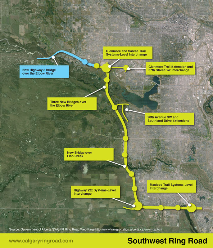 (The previous Southwest ring road route in green, with the addition of a portion of Highway 8 in blue, making up the most recent Southwest ring road alignment.2)
This section of Highway 8, between Sarcee trail and 101st street, has played an important role in the history of the ring road, not only recently, but for many years before.
South Morley Trail, Springbank Trail, Richmond Road and Highway 8
The modern Highway 8 partially follows the route of one of the oldest roads on Calgary’s west side. Richmond road, first known as South Morley Trail, was a key trail west of the city in the 19th century, and originally connected Calgary to the Stoney Nakoda First Nation Reserve via Springbank.3
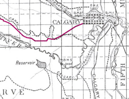 (The Richmond road corridor highlighted in pink, 1894.3)
Continue reading “Highway 8 and the Ring Road”
