A Brief History of the Southeast Calgary Ring Road

The opening of the southeast Calgary ring road in November marked not only the completion of over three years of construction, but also of the fulfillment of a goal first set out by the Province of Alberta nearly 60 years earlier.

1955-2013_SE
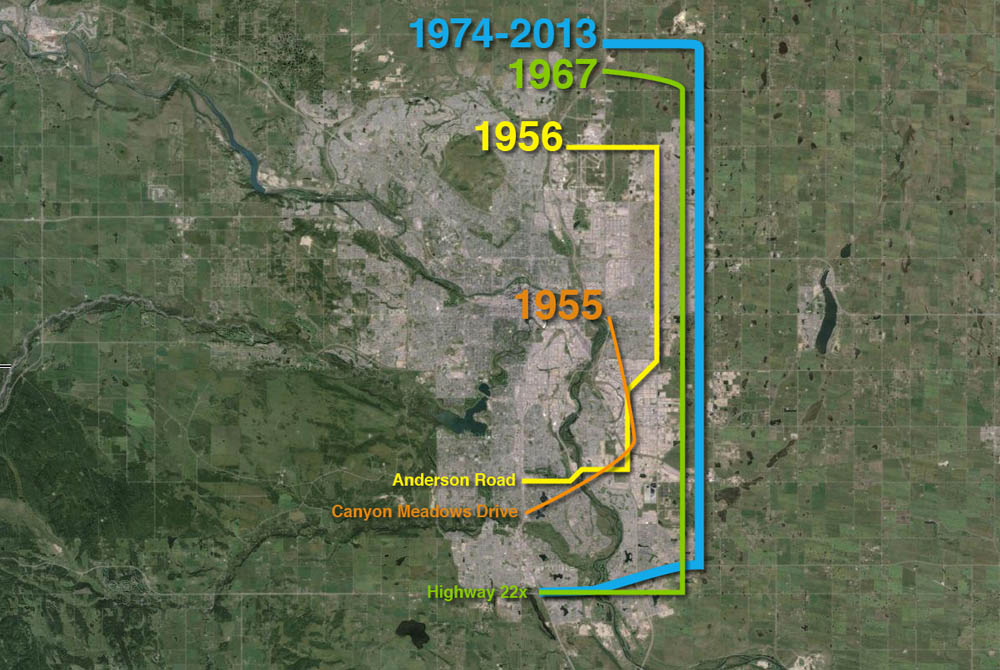
(A progression of bypass proposals for East Calgary is shown above)
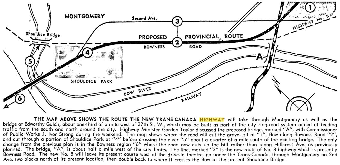
Early Bypasses

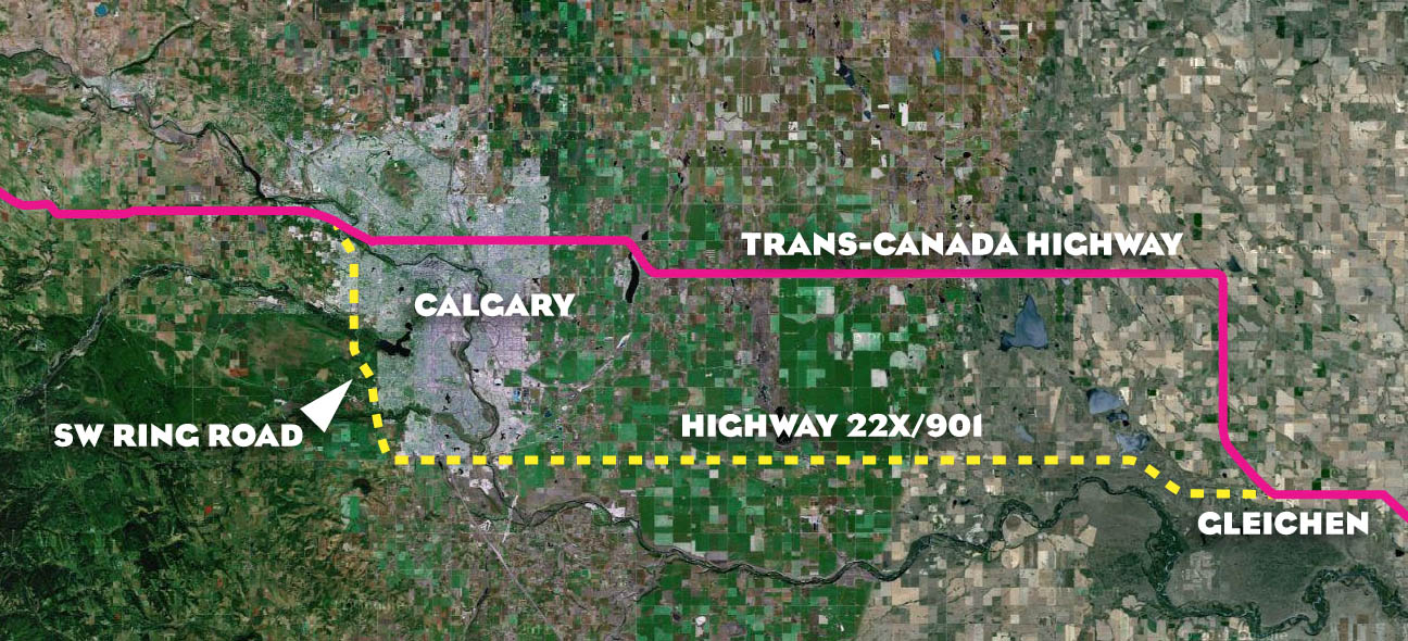
In the 1950s, when bypass plans were first considered for the Calgary area, the city’s main arterial roads radiated from the core, and the primary bridges over the City’s rivers were largely located downtown. To access the industrial southeast, residents living in the new suburbs of the northwest and southwest would have to drive through or near the increasingly congested core. In order to allow drivers not bound for downtown to bypass central Calgary, and in order to allow long-range travelers to connect between major highways without adding to the congestion of the city, several bypass roads would be proposed that would avoid the city centre. These early bypass plans would include such a facility along the city’s southeastern edge.

Continue reading “A Brief History of the Southeast Calgary Ring Road”

Advertisement

The Trans-Canada Highway and the Ring Road

The origins of the ring road can be traced back to a time when the Trans-Canada highway was first being planned and constructed through Calgary, and the history of these two roads are intertwined. Both the northern and southern potions of the ring road have played a part in the story of the highway in the Calgary area.

transcanada_01

In the mid- to late-1940s the Government of Canada instructed each Province to select a route for the Trans-Canada highway through their territory. By 1949, in conjunction with BC and Saskatchewan, Alberta decided on a general route that would travel through Calgary, as opposed to a more northern route through Edmonton or a more southern route through the Crowsnest Pass. Although the highway would ultimately travel through the city via 16th avenue north and Bowness, other alignments were studied before a final route was decided upon.

1956-TCH-map

Early in the process the City of Calgary had proposed a route for the highway that would have seen the road cross the Bow River at the Shaganappi Trail and head southwest through what is now Edworthy park (road ‘A’ shown in the map above). This river crossing was also part of the city’s ring road plans at the time, but was rejected by the Province for the Trans-Canada alignment, preferring a crossing at Shouldice instead. Continue reading “The Trans-Canada Highway and the Ring Road”