
This is the fourth and final part of my overview of the Calgary Ring Road project, covering the period from 2000 to the current day. In many ways this is the period that moved the full ring road project from concept to reality. Despite a small portion having been built in the previous decade, work on a high-capacity, free-flowing provincial highway got underway in earnest after the turn of the millennium; work that is still ongoing today. (Click here for Part 1: 1956-1970, here for Part 2 1974-1976, and here for Part 3 1980-2001) As always, click on any of the maps for a larger view.
BECOMING A PROVINCIAL HIGHWAY
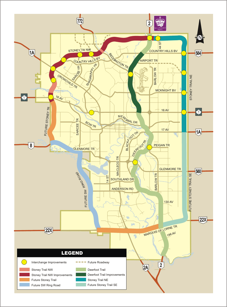
In 2000, the City of Calgary and the Province of Alberta signed an agreement that transfered the control of both the Deerfoot Trail and Stoney Trail to the Province. Despite the road originating in Provincial plans, and being primarily designed by the Province since the 1970s, the Calgary ring road had to this point been a City road. Continue reading “The Ring Road System – The Provincial Road (2001 to 2012)”


