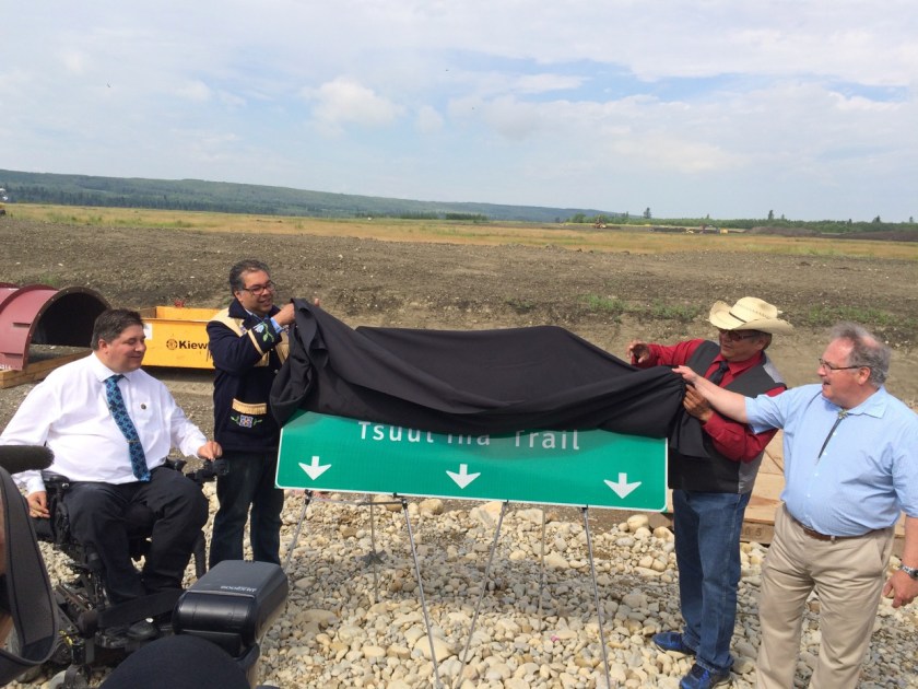
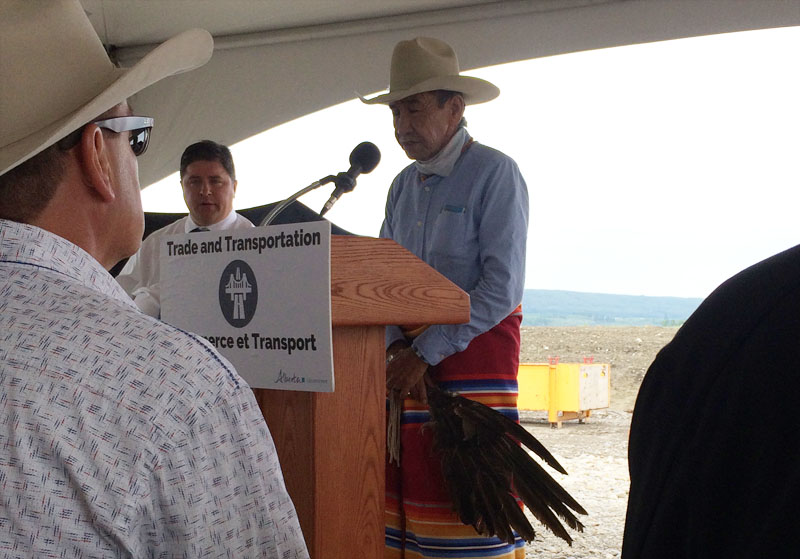
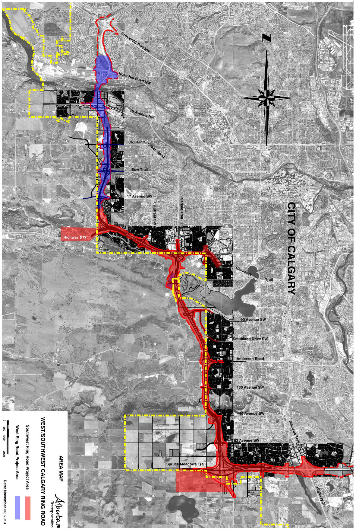
Next year, a new development located on the Tsuut’ina Nation reserve is set to be officially unveiled. The project, the result of a partnership between the Tsuut’ina Nation and the developer Canderel, is located along a 10km portion of the Southwest Calgary Ring Road, and is being touted as a transformative combination of retail, commercial, entertainment, health, residential and tourism amenities on Calgary’s doorstep.

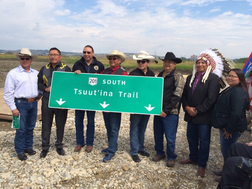
Given that the development relies on access from the ring road, known as Tsuut’ina Trail as it crosses the reserve, it would be easy to see the project as a direct result of the construction of this road. However, it’s more accurate to say that the construction of the road is a direct result of the Nation’s desire to develop reserve land on Calgary’s border.
Although the proposed development is certainly a new undertaking for the Nation, the idea of developing land on the reserve’s eastern edge is one that’s been nearly 50 years in the making. The planning for both the road and the developments were initially done independently of each other, with each involved party willing, or even preferring, to proceed without the other. As time went on it became increasingly clear that neither could be completed without the other, and the two projects eventually became inseparable.
PURSUIT OF SELF-DETERMINATION
The Nation has derived economic benefit from reserve land in different ways over the years, including royalties from oil and gas extraction, land leases, and the sale of surface resources such as timber and gravel. Though important, these sources of income alone have not always provided the growing community with the resources it needed to be prosperous. In the early 1970s the Tsuut’ina Nation sought to create more ambitious economic enterprises, and looked to take advantage of the proximity of the City of Calgary to help make that happen. In recent years those plans have revolved around the Southwest Calgary Ring Road, though this was not always the case.
In 1970, Tsuut’ina citizens Reg One Spot and Arnold Crowchild were appointed to head up a newly-formed economic committee by the Nation’s Chief and Council.1 The committee’s mandate was to explore development opportunities on reserve lands, and to assess the benefits and drawbacks of any such initiatives.
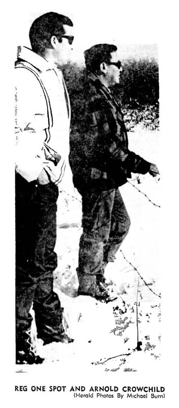
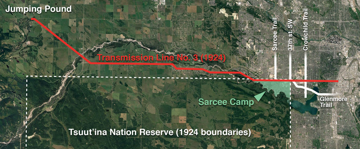
For many years, portions of the Tsuut’ina reserve had generated rent under long-term leases to the Canadian Military. The Nation, however, was now looking beyond land leases. The new committee was not seeking to simply lease empty land to third-party developers, but instead were looking at ways for the Nation itself to become a developer in order to reap rewards larger than rent alone would provide. Arnold Crowchild explained their position in November of 1970; “What the tribe could get from leasing this land out may seem like considerable money, but it is only a drop in the bucket compared to what we could get if we developed it ourselves”.2
Beyond the financial benefits for the Nation as a whole, the ability to develop the land was seen as critical in improving the employment opportunities of Nation members. The Nation’s employment rate was far below that of neighbouring Calgary in the 1970s, with a reported 50-70% of the Nation unemployed, depending on the season3. “The most important thing for us right now is to create jobs for our people. We can only do this by setting up our own enterprises” the economic development team is quoted as saying.4
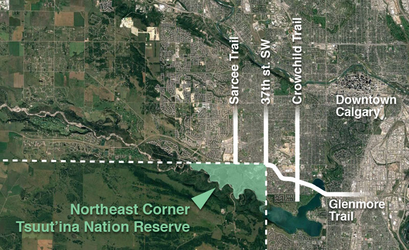
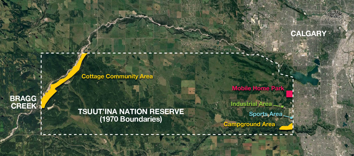
The east side of the Nation’s reserve, being directly adjacent to Calgary, was seen as an ideal place to explore development opportunities. This portion of the reserve benefits from its close proximity to the city, including access to potential customers and the City’s transportation network, and was viewed as some of the most viable land for commercial development. The relationship between the Nation and local city residents was noted as an important consideration for any potential development, and this relationship was to be maintained by sensitive developments. “[Our developments] would have to be clean industries so we won’t develop bad relations with our City neighbours close-by” said Mr. Crowchild and Mr. One Spot5, a position which would be reiterated by a soon-to-be-released consultant’s report.
AN INITIAL PLAN
In 1971 a $75,000 study was written by Stanley Associates Engineering Ltd.6 in order to help assess the development potential of the reserve. From this report a five-project development plan was created that was intended to unlock the commercial value of the land. This plan called for the development of:
- 189 acres in the Southeast corner of the reserve along Fish Creek/Wolf Creek for a tent and RV campground, with a golf course and swimming facilities,
- 16 acres south of Anderson Road/Bull Head Road for a sports and recreation complex, including a hockey arena, tennis courts, football field and swimming pool,
- 160 acres adjacent to Oakridge and Cedarbrae for a mobile home park,
- 10 acres for an industrial park, and
- 1,500 acres near Bragg Creek on the reserve’s west end for a residential ‘cottage community’
The study also recommended the creation of a new legal body through which the Nation could carry out its development projects. In 1971 Sarcee Developments Ltd. was established, a company wholly-owned by the Nation, with Reg One Spot and Arnold Crowchild becoming its founding directors.7
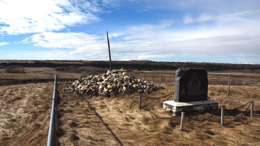
The last proposal on the consultant’s list, the ‘cottage community’ near Bragg Creek, is arguably the most economically successful of the Nations early development plans. However Redwood Meadows, as this residential and golf-course development is known, is located on the reserve’s west side, and is therefore the development least impacted by the Southwest Calgary Ring Road story. Though Redwood Meadows is deserving of its own article delving into its history, I will not be covering that story here, and will instead focus on developments found on the east side of the reserve. Continue reading “The Road to Development, part 1”