From No to Maybe: The turning point for the SW Ring Road, part 1

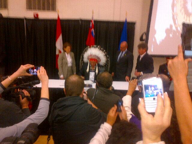
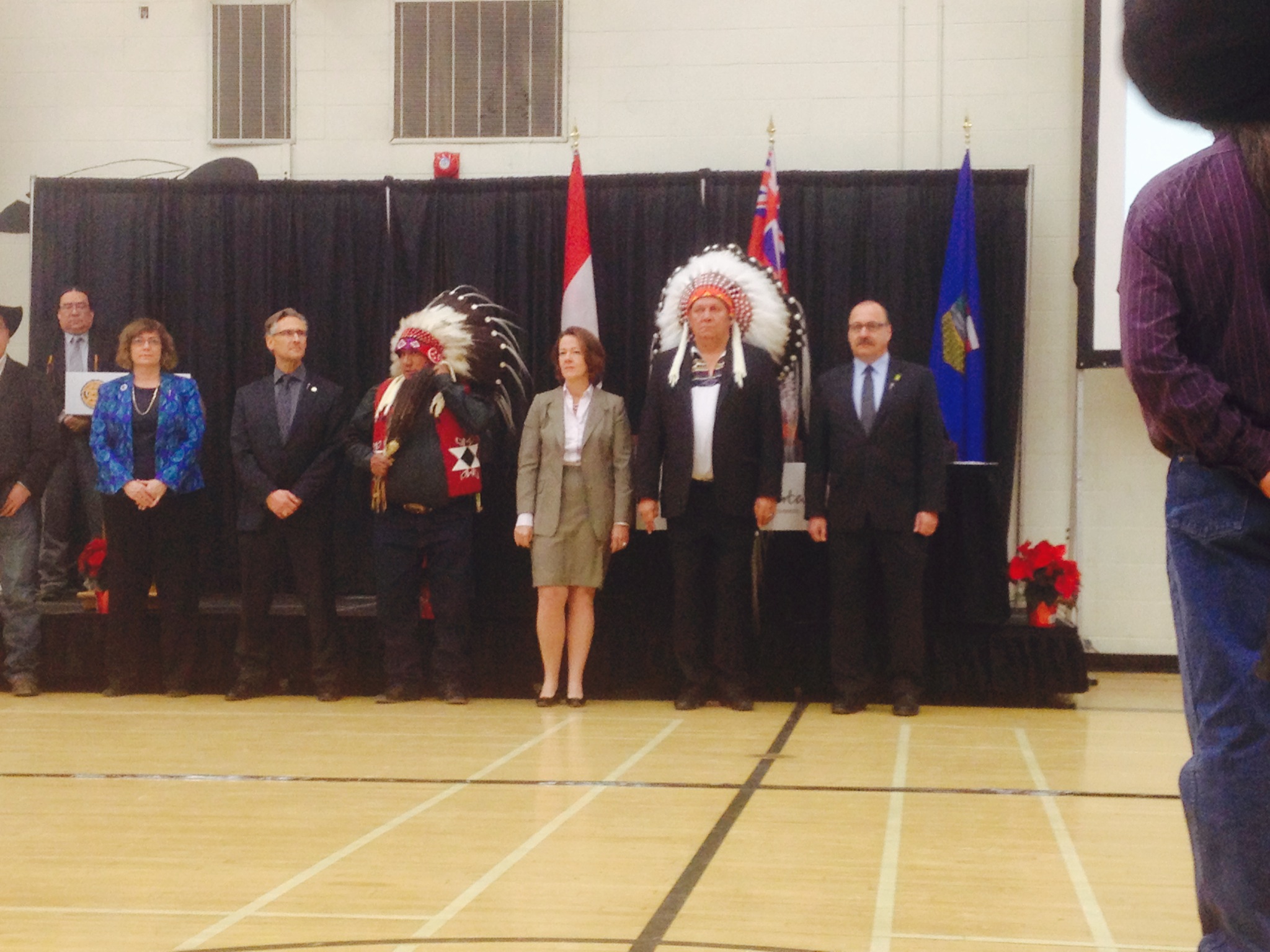
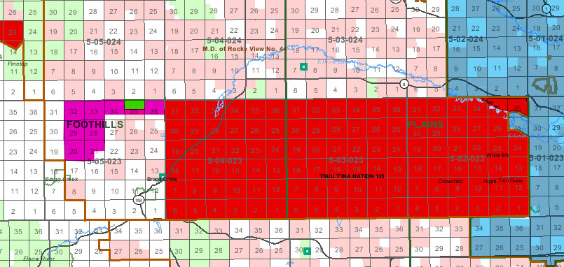
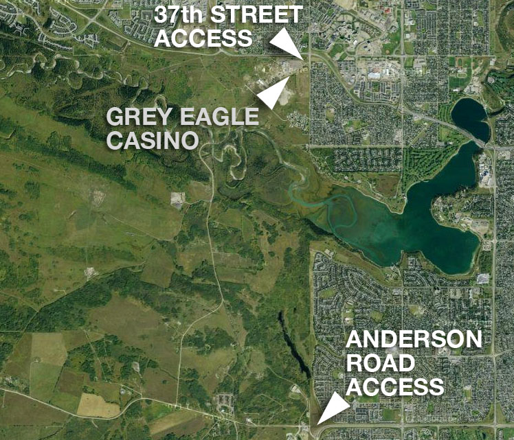
The approval of a ring road agreement between the Tsuut’ina and the Province of Alberta in October of 2013 has opened the door for the long-planned Southwest Calgary Ring Road to be built through what is currently the Tsuut’ina Nation reserve. By any measure, the vote to accept the deal was overwhelmingly in favour, but the idea of selling reserve land for the freeway has not always been a popular one amongst Nation members.

With a deal now agreed to locate the ring road through the reserve, a once formidable divide between the idea of retaining reserve land and selling it has seemingly been bridged, but what changed? Why has that idea of selling the land, once thoroughly rejected by Tsuut’ina members and leadership, now been embraced?

Ring Road Planning

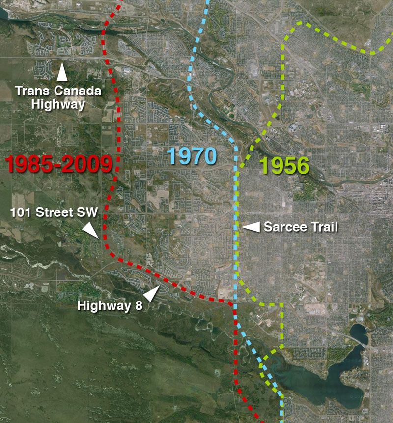
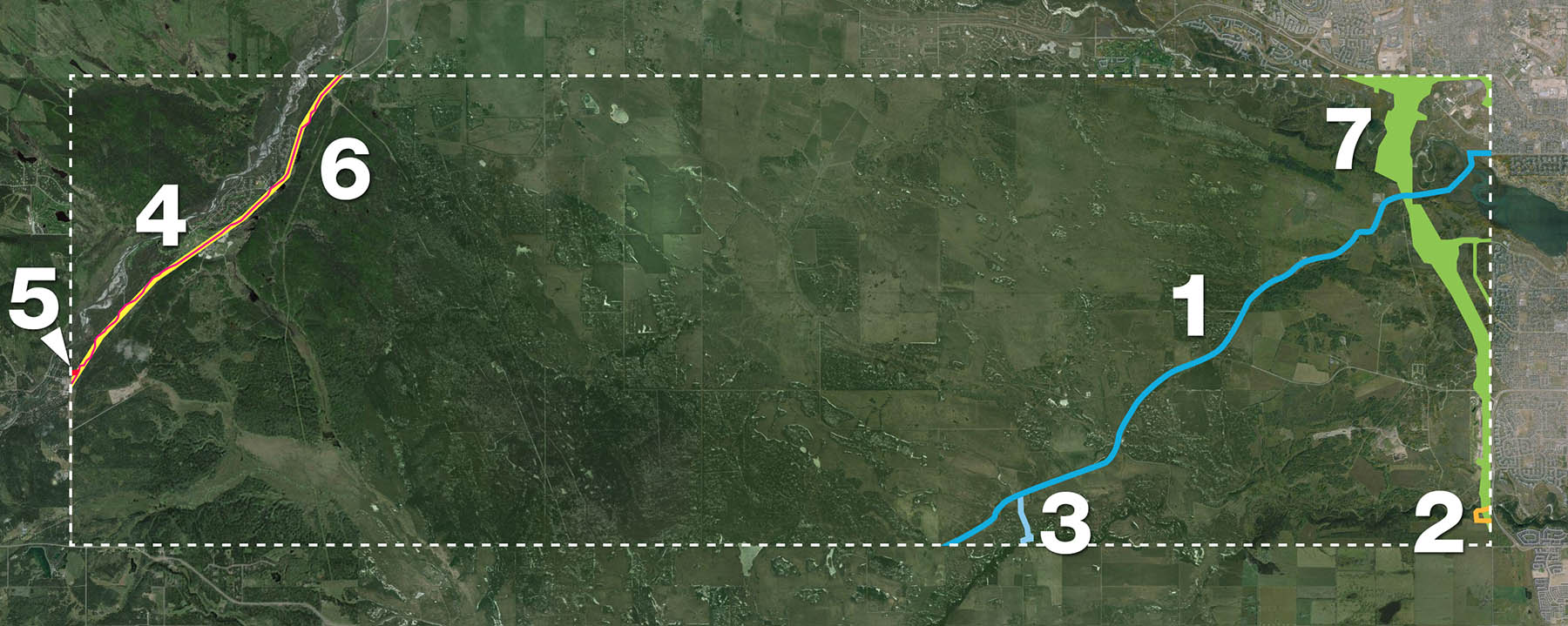
Although Calgary had planned for a ring road from as early as the mid-1950s, the early designs would have seen limited, or at times non-existent, incursions into the Tsuut’ina reserve. Early designs were proposed to be largely located within Calgary’s city limits, and while there have been sporadic discussions between the City and the Nation regarding the acquisition of land for a road, in the early days these talks would appear to be perfunctory.

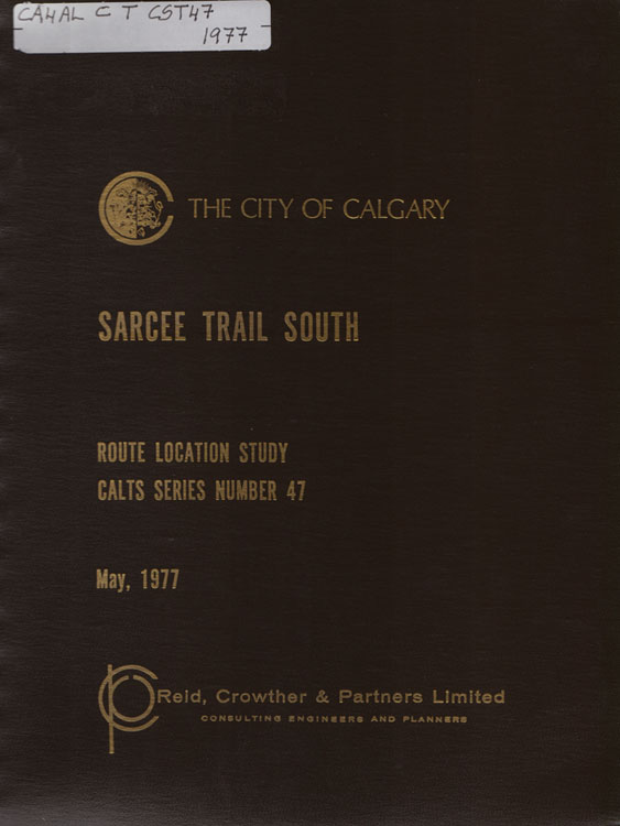
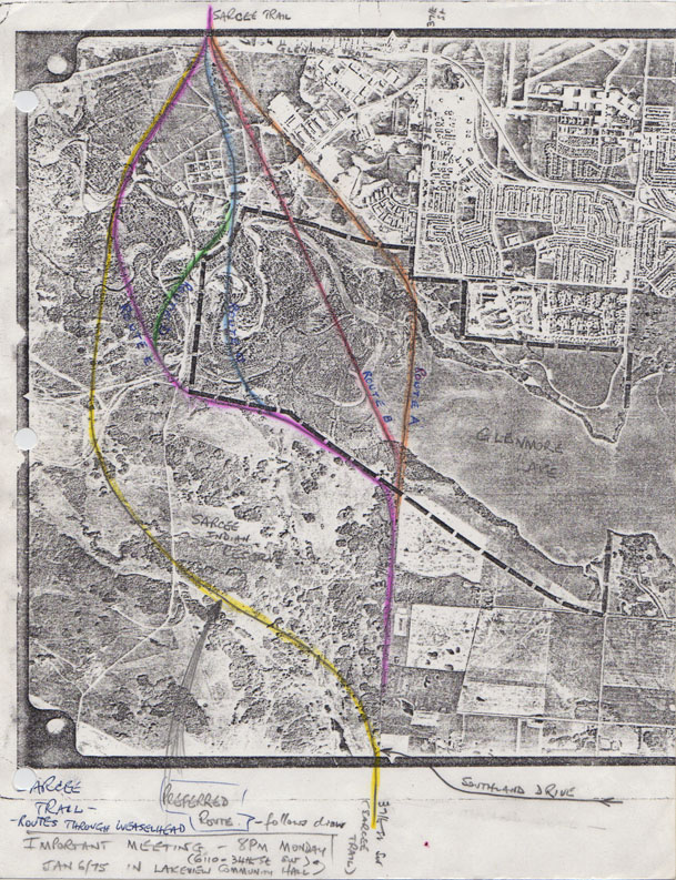
It wasn’t until the 1970s that more considered thought was given to planning the Southwest Calgary Ring Road through the Tsuut’ina reserve in a substantial way.

1975_ROUTE_F Continue reading “From No to Maybe: The turning point for the SW Ring Road, part 1”

Advertisement

The West Calgary Ring Road

Though the route of the southwest ring road through the Tsuut’ina reserve has in recent years garnered the most attention of the unfinished portions of Calgary’s bypass network, there are actually two additional pieces of infrastructure needed to complete the ring. Aside from the south leg, which extends the road to Macleod Trail in the south, there is also the West Calgary Ring Road, defined as the portion of the road that connects the Trans Canada Highway to Highway 8. This is the piece that I will cover here.

Early West Side Planning

1956-2009_west_ring_road

The earliest complete plans for a ring road around Calgary, dating from 1956, plotted much of the western leg of the circuit along the 53rd street SW corridor, better known today as Sarcee Trail. While the route to the north and south of this leg would undergo revisions, this western portion would remain largely unchanged for nearly 30 years, and the road would continue to be planned along the Sarcee Trail corridor until the mid 1980s. Continue reading “The West Calgary Ring Road”

SW Ring Road Signing

At a ceremony today, held at the Tsuut’ina Seven Chiefs Sportsplex, the 2013 ring road agreement was signed by Tsuut’ina Chief Roy Whitney, Premier Alison Redford and Transportation Minister Ric McIver.

2013_signing(Picture courtesy of Parker Hogan, Alberta Transportation)

Noting the agreement signifies the beginning of a long friendship between the Province and the Nation, McIver stated that the name of the road will be chosen by the Tsuut’ina, and that the project will include Tsuut’ina motifs. Chief Whitney noted that discussions of the ring road through the Nation have been ongoing for ‘over 60 years’, and that the project will bring benefits for the language, culture and economics of the Nation. He also characterized the agreement as probably the most important modern event in the history of the Tsuut’ina.

photo (2)

(Picture courtesy of Amy Lonsberry)

The signing of the agreement marks a historic milestone in the development of this road, and has moved the Southwest Calgary Ring Road project forward with the next steps involving the approval of the federal government. McIver stated in a press release “We will work in partnership with the Tsuut’ina Nation and the federal government to proceed with the land transfer. This work will be guided by a committee with representatives from all parties and we will continue to work together in good faith.”

Once the land transfers have been enacted, the Province will have seven years to complete the opening phase of the southwest ring road.

Road Purchases and Surrenders

The October 2013 ring road agreement between the Province of Alberta and the Tsuut’ina Nation has recently been heralded by the Province and the media as a historic agreement between these two parties. While the scale, compensation and long-term impacts of this deal are indeed unique, representing the largest ever land purchase from the Tsuut’ina reserve and the potential opening of the reserve for unprecedented development, it is not the first time a road corridor has been acquired by the Province through the reserve. The ring road agreement actually represents the seventh time that a Provincial road corridor has been secured through Tsuut’ina lands.

all_corridors_1900-20131. Priddis Trail, 1900
2. 37th Street SW, 1910
3. Priddis Trail Diversion, 1916
4. Highway 22/Bragg Creek Road, 1922
5. Balsam Avenue Bridge Approach, 1934
6. Highway 22 Widening, 1955
7. Southwest Calgary Ring Road, 2013

Continue reading “Road Purchases and Surrenders”

Land Transfers

There has been discussion about the potential for a land transfer component in the pending southwest Calgary ring road deal between the Province and the Tsuu T’ina. Concerns have been raised publicly about the status of the new land that the Tsuu T’ina might acquire, and whether or not this land would be integrated into the reserve. In a recent Calgary Journal article, Jean Crowder, MP and Official Opposition Critic for Aboriginal Affairs, questioned whether the new lands included in the agreement would in fact be reserve land.

new_reserve_lands

The map above shows the new lands (magenta) proposed to be added to the reserve (red) in the 2009 deal.

Without knowing the details of the 2013 agreement, we can currently only look at the 2009 deal to see how land ownership and transfers were proposed in regards to this project. The details about ownership and transfer that follow are based on the wording of the 2009 deal (which can be downloaded in full here). For a further look at the 2009 deal, click here. Continue reading “Land Transfers”

Casino Access and Bargaining Chips

In July of 2009, Calgary Mayor Dave Bronconnier stated “One thing is for sure. The legal access to the First Nation’s land is off of Anderson Road. And so we will have to accommodate and work with our neighbours as we always do… At the end of the day, we need to build an interchange at 37th Street SW and Glenmore (trail) and, most importantly, Calgarians just want us to get on with it.” Over the next few days, Bronconier indicated that while access to the reserve would always be maintained at Anderson Road, the access to the reserve and the Tsuu T’ina’s Grey Eagle Casino at Glenmore Trail and 37th street SW was only ‘considered temporary’. This was disputed by the Nation, and soon legal threats were issued over potential limits to reserve access.

37th_and_anderson_access

The concept of a single, legally required access point between the City of Calgary and the Tsuu T’ina reserve has been raised in recent years by politicians and the media. So too has the suggestion that the access road to the Grey Eagle Casino is only temporary in nature. However, is this really the case? Is the City only required to provide a single connection? Is the entrance to the reserve near the casino provided as a courtesy, or does that access exist as a right of the Nation? The issue around this access point is highly charged, politically sensitive, and like most aspects of this story, comes with a long history behind it. Continue reading “Casino Access and Bargaining Chips”

2013 Referendum

On September 19 2013, Transportation Minister Ric McIver confirmed a story published in the Calgary Journal the day before, and announced that the past several years of negotiations between the Tsuu T’ina and the Province regarding the ring road had come to a fruitful conclusion with the finalization of a new ring road deal. According to the Journal, on September 10 the Tsuu T’ina Council had approved a tentative deal regarding the land and compensation required to build the southwest Calgary ring road through the First Nation reserve. With a deal agreed upon by the Province and the Nation’s Council, all that remains is a referendum of Tsuu T’ina members, which has been set for October 24 2013. This marks only the second time that an agreement will come to a referendum of Nation members; the first, in 2009, was rejected.

Continue reading “2013 Referendum”

Unexploded Ordnance in Southwest Calgary

The 2013 southern Alberta floods did more to Calgary than damage houses and severely interrupt lives; the floods unearthed and highlighted a problem that has caused concern, and worse, for decades. In July, two unexploded military shells were found on the shores of the Elbow river in the Weaselhead area, exposing a legacy of unexploded ordnances (UXO) that lie just beneath the surface of a portion of southwest Calgary, including the potential route of the southwest ring road.

weaselhead_uxo

(Image of shell found in the Weaselhead area, July 2 2013. Courtesy Mark Langenbacher) Continue reading “Unexploded Ordnance in Southwest Calgary”

1977 Sarcee Trail South Route Location Study

Though the planning for a Southwest Ring Road had been started in the early-to-mid 1950s, it remained little more than a line on a map for the next few decades. It took the pressures of growth, and the establishment of a new Provincial park, for the City to move the project from long-range thinking to a more detailed phase of planning. By the mid 1970s the planning for the Sarcee Trail extension, as it was then known, had become a priority to the City, even if the need for the road was recognised to still be decades away.

1977_cover

The study would look at routes that traveled from Glenmore Trail to Highway 22x, though I will focus on the portion that crosses the Elbow River, from Glenmore Trail to Anderson Road. For more on the crossing of the Fish Creek, see here. Continue reading “1977 Sarcee Trail South Route Location Study”

The Southwest Calgary Toll Road

The Tsuu T’ina are holding an election today (November 26 2012) for Chief and Councillors, and naturally the issue of the ring road has been among the forefront of the issues being raised.

Two of the contenders for the position of Chief, current Councillor Ivan Eagletail and former-Chief Roy Whitney, have at one point or another been on record as favouring a toll road payable to the Tsuu T’ina Nation in order for the Southwest Calgary Ring Road to be allowed through the reserve. While Eagletail made his support known recently, Whitney last mentioned support for the toll concept over a decade ago. Though this type of deal may be a departure from the current proposals, it is not a new idea for this road. Continue reading “The Southwest Calgary Toll Road”